National Geographic
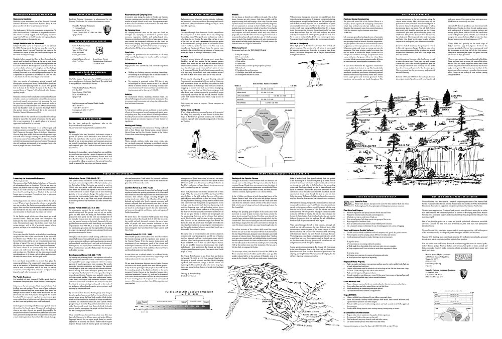
Bandelier National Monument: Map #209
Bandelier National Monument: Map #209
Couldn't load pickup availability
National Geographic Trails Illustrated Bandelier National Monument Map #209 — waterproof, tear-resistant. Coverage of Bandelier National Monument including cliff dwellings, canyon trails, and backcountry routes in New Mexico. GPS-compatible.
The National Geographic Trails Illustrated Bandelier National Monument Map covers the full monument — the Ancestral Pueblo cliff dwellings of Frijoles Canyon, Tsankawi, the backcountry mesa and canyon trail network, and surrounding Jemez Mountains terrain. Trails, cliff dwelling locations, backcountry routes, and GPS coordinates are mapped in detail.
Key specs
- SKU: NGTI209
- Map number: 209
- Coverage: Bandelier National Monument, New Mexico
- Material: Waterproof, tear-resistant paper
- Features: Trails, cliff dwelling locations, Frijoles Canyon, backcountry routes, GPS coordinates
Why it works
Bandelier's combination of accessible cliff dwellings in Frijoles Canyon and extensive backcountry mesa and canyon terrain requires a map covering both the developed and wilderness sections of the monument. The backcountry's mesa-top trails and canyon routes require accurate topographic detail for navigation in the desert terrain. Waterproof construction survives the New Mexico high desert's afternoon monsoon thunderstorms and the variable weather common in the Jemez Mountains.
Ideal for
History lovers, hikers, and families exploring Bandelier National Monument's cliff dwellings and backcountry canyons in New Mexico. See also NGTI731 (Santa Fe, Truchas Peak) for adjacent coverage in the Sangre de Cristos.
Share