National Geographic
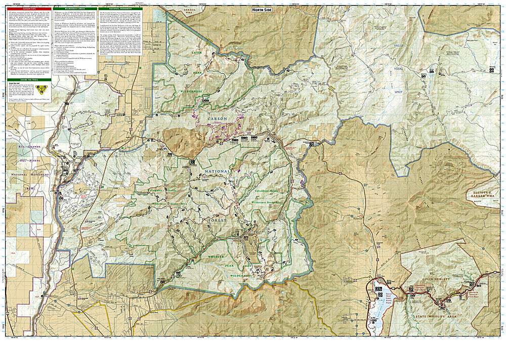
Taos, Wheeler Peak: Map #730
Taos, Wheeler Peak: Map #730
Couldn't load pickup availability
National Geographic Trails Illustrated Taos & Wheeler Peak Map #730 — waterproof, tear-resistant. Coverage of the Wheeler Peak Wilderness, Wheeler Peak (New Mexico's highest point), Taos Ski Valley, and surrounding Carson National Forest. GPS-compatible.
The National Geographic Trails Illustrated Taos & Wheeler Peak Map covers the Sangre de Cristo Mountains above Taos — Wheeler Peak (13,161 ft, New Mexico's highest point), the Wheeler Peak Wilderness, Taos Ski Valley, and surrounding Carson National Forest. Hiking and ski trails, wilderness boundaries, summit routes, trailheads, and GPS coordinates are mapped in detail.
Key specs
- SKU: NGTI730
- Map number: 730
- Coverage: Taos & Wheeler Peak area, Carson National Forest, New Mexico
- Material: Waterproof, tear-resistant paper
- Features: Trails, Wheeler Peak Wilderness, summit routes, Taos Ski Valley, wilderness boundaries, GPS coordinates
Why it works
Wheeler Peak is New Mexico's highest point and a popular mountaineering objective from Taos — accurate summit route and approach trail detail is essential for hikers attempting the peak. Taos Ski Valley's summer hiking trail network and the Wheeler Peak Wilderness's backcountry terrain require detailed mapping for navigation. Waterproof construction survives the Sangre de Cristo Mountains' monsoon season thunderstorms and the variable weather common at Wheeler Peak's high elevation.
Ideal for
Mountaineers, hikers, skiers, and outdoor enthusiasts exploring Wheeler Peak, the Wheeler Peak Wilderness, and Taos Ski Valley in New Mexico. See also NGTI731 (Santa Fe & Truchas Peak) for adjacent coverage to the south.
Share