National Geographic
Fontana, Hiwassee: Map #784
Fontana, Hiwassee: Map #784
Couldn't load pickup availability
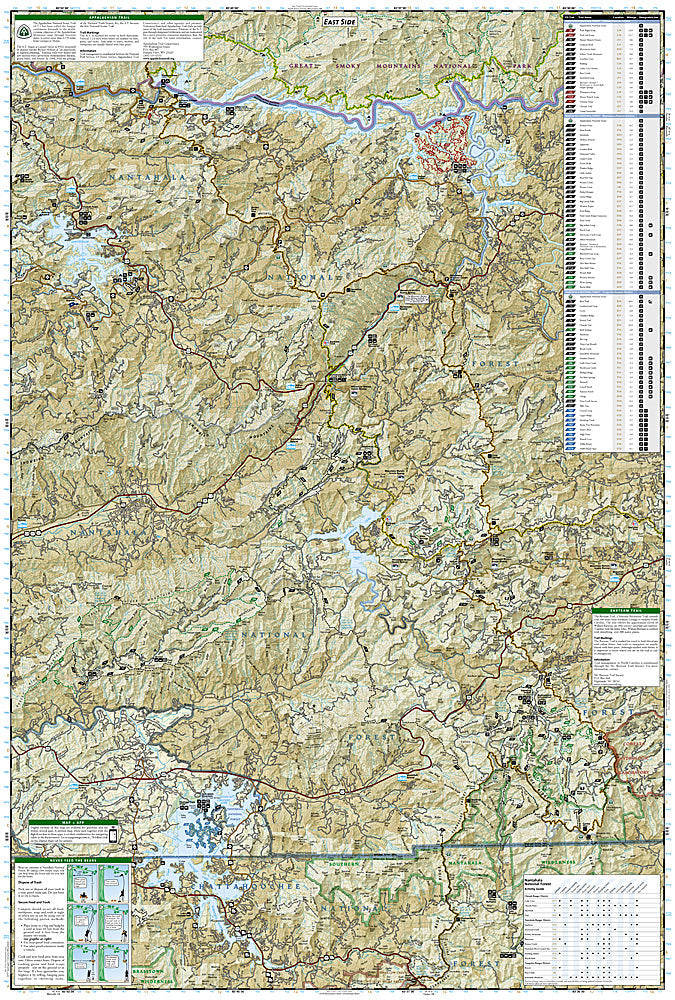
National Geographic Trails Illustrated Fontana & Hiwassee Map #784 — waterproof, tear-resistant. Coverage of the Fontana Lake area, Hiwassee Lake, Joyce Kilmer Memorial Forest, and surrounding Nantahala National Forest in western North Carolina. GPS-compatible.
The National Geographic Trails Illustrated Fontana & Hiwassee Map covers the western tip of North Carolina — Fontana Lake and Dam, the Appalachian Trail near Fontana, Hiwassee Lake, Joyce Kilmer Memorial Forest, and surrounding Nantahala National Forest. Trails, boating access, scenic drives, campgrounds, and GPS coordinates are mapped in detail.
Key specs
- SKU: NGTI784
- Map number: 784
- Coverage: Fontana & Hiwassee area, Nantahala National Forest, North Carolina
- Material: Waterproof, tear-resistant paper
- Features: Trails, AT near Fontana, Joyce Kilmer Memorial Forest, Fontana & Hiwassee Lakes, boating access, GPS coordinates
Why it works
Fontana Dam is the southern gateway to Great Smoky Mountains National Park for AT thru-hikers, and the surrounding Nantahala National Forest offers extensive hiking and boating that requires detailed mapping to navigate. Joyce Kilmer Memorial Forest contains one of the finest stands of old-growth forest in the eastern US, with a trail network that requires accurate mapping. Waterproof construction survives the frequent rain and high humidity common in the southern Appalachians.
Ideal for
AT hikers, boaters, anglers, and nature lovers exploring the Fontana and Hiwassee area of western North Carolina. See also NGTI785 (Nantahala & Cullasaja Gorges) for adjacent coverage.
Share