National Geographic
DuPont State Recreational Forest: Map #504
DuPont State Recreational Forest: Map #504
Couldn't load pickup availability
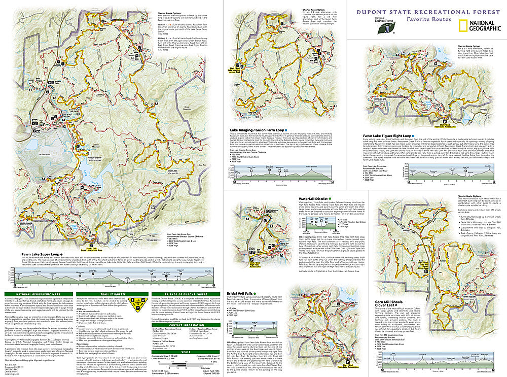
National Geographic Trails Illustrated DuPont State Recreational Forest Map #504 — waterproof, tear-resistant, scale 1:24,000. Coverage of over 80 miles of trails in DuPont State Recreational Forest including hiking, mountain biking, and equestrian routes, waterfall locations, and parking areas in North Carolina. GPS-compatible.
The National Geographic Trails Illustrated DuPont State Recreational Forest Map covers the full trail network of DuPont State Recreational Forest in western North Carolina — over 80 miles of hiking, mountain biking, and equestrian trails, the forest's famous waterfalls (Triple Falls, High Falls, Hooker Falls), and parking areas. Trail mileages, waterfall locations, and GPS coordinates are mapped in detail.
Key specs
- SKU: NGTI504
- Map number: 504
- Scale: 1:24,000
- Coverage: DuPont State Recreational Forest, North Carolina
- Material: Waterproof, tear-resistant paper
- Features: 80+ miles of trails, waterfall locations, parking areas, trail mileages, GPS coordinates
Why it works
DuPont State Recreational Forest's dense trail network and multiple waterfalls make it one of the most popular outdoor destinations in western North Carolina — the 1:24,000 scale provides the detail needed to navigate the interconnected trail system efficiently and locate the waterfalls that are the forest's main draw. The multi-use trail network serves hikers, mountain bikers, and equestrians on different designated routes that require clear mapping to avoid conflicts. Waterproof construction survives the frequent rain and high humidity common in the southern Appalachians.
Ideal for
Hikers, mountain bikers, equestrians, and waterfall seekers exploring DuPont State Recreational Forest's trail network in western North Carolina. See also NGTI780 (Pisgah National Forest) for adjacent coverage.
Share