National Geographic
Bozeman, Big Sky, Bridger Range: Map #723
Bozeman, Big Sky, Bridger Range: Map #723
Couldn't load pickup availability
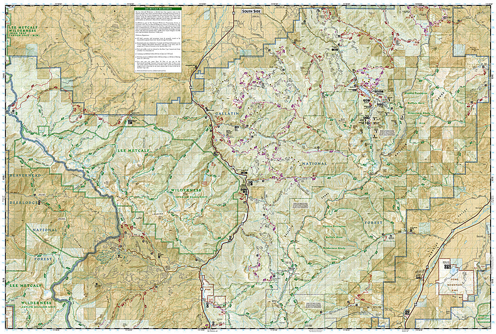
National Geographic Trails Illustrated Bozeman, Big Sky & Bridger Range Map #723 — waterproof, tear-resistant, scale 1:63,360. Coverage of the Bridger Range, Gallatin Canyon, Big Sky, and surrounding Gallatin National Forest near Bozeman, Montana. GPS-compatible.
The National Geographic Trails Illustrated Bozeman, Big Sky & Bridger Range Map covers the outdoor recreation areas surrounding Bozeman, Montana — the Bridger Range, Gallatin Canyon, Big Sky Resort area, the Spanish Peaks Wilderness, and surrounding Gallatin National Forest. Trails, ski area terrain, wilderness boundaries, trailheads, and GPS coordinates are mapped in detail.
Key specs
- SKU: NGTI723
- Map number: 723
- Scale: 1:63,360
- Coverage: Bozeman, Big Sky & Bridger Range area, Montana (Gallatin NF)
- Material: Waterproof, tear-resistant paper
- Features: Trails, Bridger Range, Gallatin Canyon, Spanish Peaks Wilderness, ski areas, GPS coordinates
Why it works
Bozeman is one of the fastest-growing outdoor recreation hubs in the Rocky Mountain West, with the Bridger Range providing immediate backcountry access from town and the Gallatin Canyon offering world-class hiking, skiing, and whitewater within 30 minutes. The Spanish Peaks Wilderness and the Big Sky area add significant backcountry coverage. Waterproof construction survives Montana's variable weather from summer thunderstorms to early-season snow on the Bridger ridgeline.
Ideal for
Hikers, skiers, mountain bikers, and outdoor enthusiasts exploring the Bozeman, Big Sky, and Bridger Range area in Montana. See also NGTI722 (Absaroka-Beartooth Wilderness East) for adjacent coverage to the southeast.
Share