National Geographic
Glacier National Park, Two Medicine: Map #315
Glacier National Park, Two Medicine: Map #315
Couldn't load pickup availability
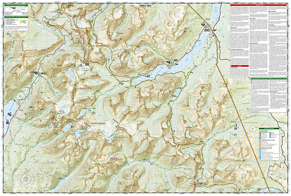
National Geographic Trails Illustrated Glacier National Park Two Medicine Map #315 — waterproof, tear-resistant. Coverage of the Two Medicine and Cut Bank areas of Glacier National Park — the park's quieter southeastern corner. GPS-compatible.
The National Geographic Trails Illustrated Glacier National Park Two Medicine Map covers the southeastern corner of Glacier National Park — the Two Medicine area, Cut Bank, the Blackfeet Reservation boundary, and surrounding backcountry. Trails, backcountry campsites, lake access, and GPS coordinates are mapped in detail.
Key specs
- SKU: NGTI315
- Map number: 315
- Coverage: Glacier National Park Two Medicine & Cut Bank areas, Montana
- Material: Waterproof, tear-resistant paper
- Features: Trails, Two Medicine Lake, Cut Bank area, backcountry campsites, GPS coordinates
Why it works
The Two Medicine area is one of Glacier's least-visited districts, offering dramatic mountain scenery and excellent hiking with far fewer crowds than the Going-to-the-Sun Road corridor — a detailed map of this area is essential for visitors seeking solitude in the park. The Cut Bank area's remote trails see very little traffic and require accurate mapping for safe navigation. Waterproof construction survives Glacier's frequent rain and the early-season snow common in the northern Rockies.
Ideal for
Hikers, backpackers, and solitude seekers exploring the Two Medicine and Cut Bank areas of Glacier National Park. See also NGTI314 (Many Glacier, Waterton Lakes) and NGTI215 (Glacier & Waterton Lakes) for broader park coverage.
Share