National Geographic
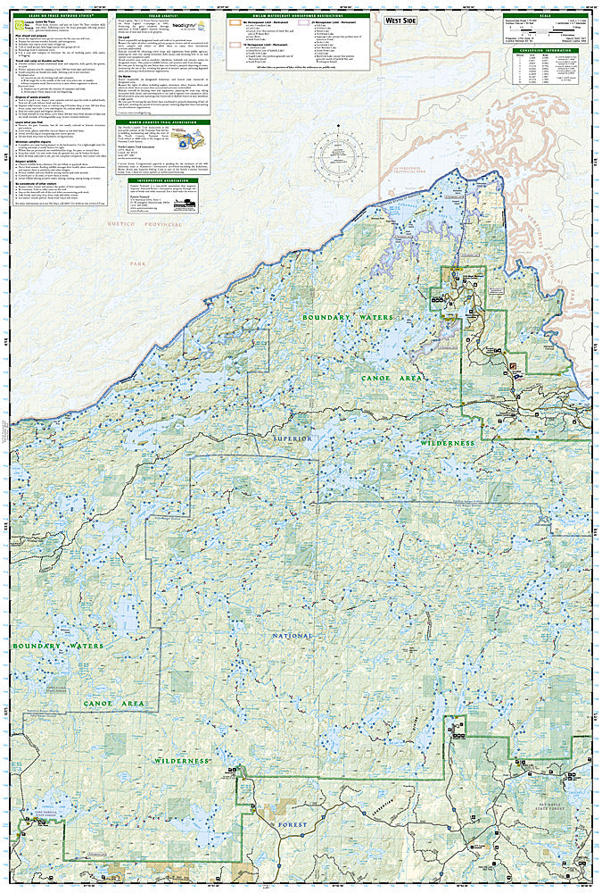
East Superior National Forest: Map #752
East Superior National Forest: Map #752
Couldn't load pickup availability
National Geographic Trails Illustrated East Superior National Forest Map #752 — waterproof, tear-resistant. Coverage of the eastern Superior National Forest including the Boundary Waters Canoe Area Wilderness approach and surrounding lake and forest terrain in northern Minnesota. GPS-compatible.
The National Geographic Trails Illustrated East Superior National Forest Map covers the eastern section of Superior National Forest in northern Minnesota — the Boundary Waters Canoe Area Wilderness approach, Gunflint Trail corridor, and surrounding lake and forest terrain. Trails, canoe routes, campgrounds, lake access, and GPS coordinates are mapped in detail.
Key specs
- SKU: NGTI752
- Map number: 752
- Coverage: East Superior National Forest, Minnesota (BWCAW approach)
- Material: Waterproof, tear-resistant paper
- Features: Trails, BWCAW entry points, Gunflint Trail, canoe routes, campgrounds, GPS coordinates
Why it works
The eastern Superior National Forest and Gunflint Trail corridor provide access to some of the most remote BWCAW entry points, requiring detailed entry point and portage mapping for canoe trip planning. The forest's dense lake network and the BWCAW's permit zone boundaries require accurate mapping for compliance and navigation. Waterproof construction is essential in Minnesota's lake country where maps are constantly exposed to water.
Ideal for
Canoeists, anglers, hikers, and campers exploring the eastern Superior National Forest and Boundary Waters Canoe Area Wilderness in northern Minnesota. See also NGTI753 (Superior National Forest West) for the western section.
Share