National Geographic
South Manistee National Forest: Map #759
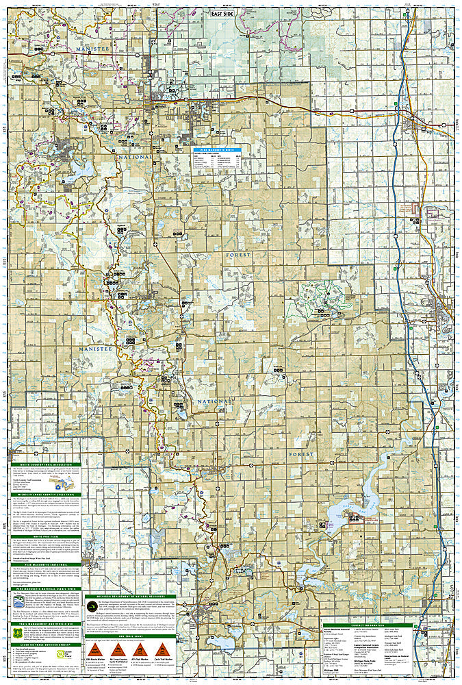
South Manistee National Forest: Map #759
Couldn't load pickup availability
National Geographic Trails Illustrated South Manistee National Forest Map #759 — waterproof, tear-resistant. Coverage of the southern Manistee National Forest including the North Country Trail, Pere Marquette River, and surrounding Lower Peninsula terrain in Michigan. GPS-compatible.
The National Geographic Trails Illustrated South Manistee National Forest Map covers the southern section of Manistee National Forest in Michigan's Lower Peninsula — the North Country Trail corridor, the Pere Marquette River (a National Wild & Scenic River and premier trout fishery), and surrounding forest terrain. Trails, NCT route, river access, campgrounds, and GPS coordinates are mapped in detail.
Key specs
- SKU: NGTI759
- Map number: 759
- Coverage: South Manistee National Forest, Michigan (Lower Peninsula)
- Material: Waterproof, tear-resistant paper
- Features: Trails, North Country Trail, Pere Marquette River, river access, campgrounds, GPS coordinates
Why it works
The Pere Marquette River is one of Michigan's most celebrated trout fisheries and a National Wild & Scenic River, with detailed river access and fishing hole mapping essential for anglers planning float trips. The North Country Trail's passage through the southern Manistee adds significant long-distance hiking coverage. Waterproof construction survives Michigan's frequent rain and the river environment along the Pere Marquette.
Ideal for
Paddlers, anglers, North Country Trail hikers, and campers exploring the southern Manistee National Forest and Pere Marquette River in Michigan. See also NGTI758 (North Manistee National Forest) for the northern section.
Share