National Geographic
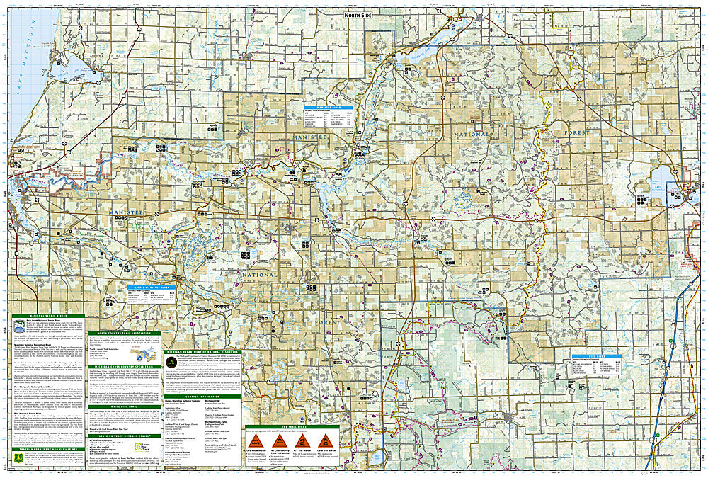
North Manistee National Forest: Map #758
North Manistee National Forest: Map #758
Couldn't load pickup availability
National Geographic Trails Illustrated North Manistee National Forest Map #758 — waterproof, tear-resistant. Coverage of the northern Manistee National Forest including the Nordhouse Dunes Wilderness, Big Manistee River, and surrounding Lower Peninsula terrain in Michigan. GPS-compatible.
The National Geographic Trails Illustrated North Manistee National Forest Map covers the northern section of Manistee National Forest in Michigan's Lower Peninsula — the Nordhouse Dunes Wilderness (the only federally designated wilderness in Michigan's Lower Peninsula), the Big Manistee River, and surrounding forest terrain. Trails, river access, Nordhouse Dunes routes, campgrounds, and GPS coordinates are mapped in detail.
Key specs
- SKU: NGTI758
- Map number: 758
- Coverage: North Manistee National Forest, Michigan (Lower Peninsula)
- Material: Waterproof, tear-resistant paper
- Features: Trails, Nordhouse Dunes Wilderness, Big Manistee River, river access, campgrounds, GPS coordinates
Why it works
The Nordhouse Dunes Wilderness is the only federally designated wilderness area in Michigan's Lower Peninsula, offering a unique combination of Lake Michigan shoreline dunes and forest terrain that requires detailed trail and dune access mapping. The Big Manistee River is one of Michigan's premier trout fishing and paddling rivers. Waterproof construction survives Michigan's frequent rain and the lake environment near the Lake Michigan shoreline.
Ideal for
Hikers, paddlers, anglers, and campers exploring the Nordhouse Dunes Wilderness, Big Manistee River, and northern Manistee National Forest in Michigan. See also NGTI759 (South Manistee National Forest) for the southern section.
Share