National Geographic
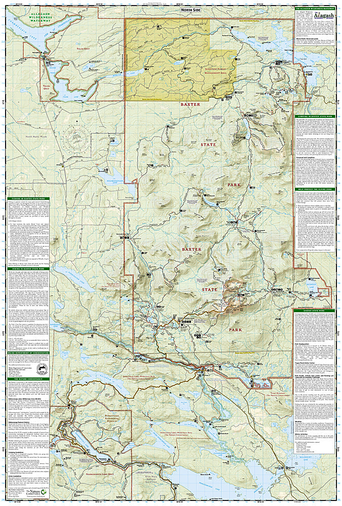
Baxter State Park, Mount Katahdin: Map #754
Baxter State Park, Mount Katahdin: Map #754
Couldn't load pickup availability
National Geographic Trails Illustrated Baxter State Park & Mount Katahdin Map #754 — waterproof, tear-resistant. Coverage of Baxter State Park, Mount Katahdin (5,267 ft), the Knife Edge, and surrounding wilderness in Maine. GPS-compatible.
The National Geographic Trails Illustrated Baxter State Park & Mount Katahdin Map covers the full state park and Maine's highest peak — Mount Katahdin, the Knife Edge ridge, the Appalachian Trail's northern terminus at Baxter Peak, the Tableland, and surrounding Baxter State Park wilderness. Trails, AT terminus, climbing routes, lean-tos, campgrounds, and GPS coordinates are mapped in detail.
Key specs
- SKU: NGTI754
- Map number: 754
- Coverage: Baxter State Park & Mount Katahdin, Maine
- Material: Waterproof, tear-resistant paper
- Features: Trails, Knife Edge, AT terminus, climbing routes, lean-tos, campgrounds, GPS coordinates
Why it works
Mount Katahdin is the northern terminus of the Appalachian Trail and one of the most significant summits in the eastern US — the Knife Edge ridge is one of the most exposed and technically demanding trails in the Northeast, requiring accurate route and terrain detail for safe navigation. Baxter State Park's strict reservation system and the park's complex trail network require detailed campground and lean-to location mapping. Waterproof construction survives Maine's frequent rain and the variable weather common on Katahdin's exposed summit.
Ideal for
AT thru-hikers completing their journey, hikers, climbers, and wilderness lovers exploring Baxter State Park and Mount Katahdin in Maine. See also NGTI1513 (AT Maine, Pleasant Pond to Katahdin) for the AT approach coverage.
Share