National Geographic
Cape Cod: Map #250
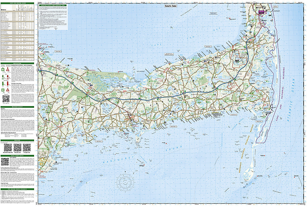
Cape Cod: Map #250
Couldn't load pickup availability
National Geographic Trails Illustrated Cape Cod Map #250 — waterproof, tear-resistant. Coverage of Cape Cod National Seashore, the Cape Cod Rail Trail, beaches, bike paths, and surrounding Cape Cod and Islands recreation areas in Massachusetts. GPS-compatible.
The National Geographic Trails Illustrated Cape Cod Map covers Cape Cod National Seashore, the Cape Cod Rail Trail, beaches, lighthouses, bike paths, and surrounding recreation areas across the Cape and Islands. Bike routes, beach access, hiking trails, and GPS coordinates are mapped in detail.
Key specs
- SKU: NGTI250
- Map number: 250
- Coverage: Cape Cod National Seashore & Cape Cod, Massachusetts
- Material: Waterproof, tear-resistant paper
- Features: Cape Cod Rail Trail, beaches, bike paths, lighthouses, hiking trails, GPS coordinates
Why it works
Cape Cod's combination of national seashore, rail trail cycling, and beach access spread across a long peninsula makes a comprehensive map essential for visitors trying to navigate between destinations efficiently. The Cape Cod Rail Trail is one of the most popular cycling routes in New England, and the National Seashore's beach and trail access points require accurate location detail. Waterproof construction survives the Cape's coastal environment where salt spray and rain are constant.
Ideal for
Cyclists, beachgoers, hikers, and vacationers exploring Cape Cod National Seashore, the Rail Trail, and the Cape's beaches and recreation areas in Massachusetts.
Share