National Geographic
Mount Jefferson, Mount Washington: Map #819
Mount Jefferson, Mount Washington: Map #819
Couldn't load pickup availability
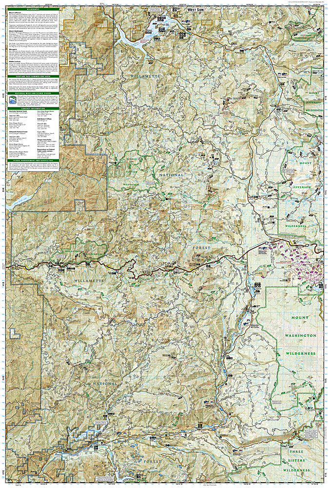
National Geographic Trails Illustrated Mount Jefferson & Mount Washington Map #819 — waterproof, tear-resistant. Coverage of the Mount Jefferson Wilderness, Mount Washington Wilderness, and Pacific Crest Trail corridor in the central Oregon Cascades. GPS-compatible.
The National Geographic Trails Illustrated Mount Jefferson & Mount Washington Map covers the central Oregon Cascades — the Mount Jefferson Wilderness, Mount Washington Wilderness, Three Fingered Jack, and the PCT corridor connecting them. Trails, PCT route, wilderness boundaries, equestrian routes, trailheads, and GPS coordinates are mapped in detail.
Key specs
- SKU: NGTI819
- Map number: 819
- Coverage: Mount Jefferson & Mount Washington Wilderness, Oregon (central Cascades)
- Material: Waterproof, tear-resistant paper
- Features: Trails, PCT corridor, Mount Jefferson & Washington Wilderness, equestrian routes, GPS coordinates
Why it works
The Mount Jefferson and Mount Washington Wilderness areas flank the PCT in the central Oregon Cascades, offering some of the most scenic high-country hiking in the state between the more famous Three Sisters and Mount Hood areas. The PCT's route through this section passes through lava fields and alpine terrain that requires accurate mapping for navigation. Waterproof construction survives the Cascades' frequent rain and the snowpack that can linger into early summer at higher elevations.
Ideal for
PCT hikers, backpackers, and equestrians exploring the Mount Jefferson and Mount Washington Wilderness areas in the central Oregon Cascades. See also NGTI818 (Bend, Three Sisters) for adjacent coverage to the south.
Share