National Geographic
Haute Route, Chamonix to Zermatt: Map #4001
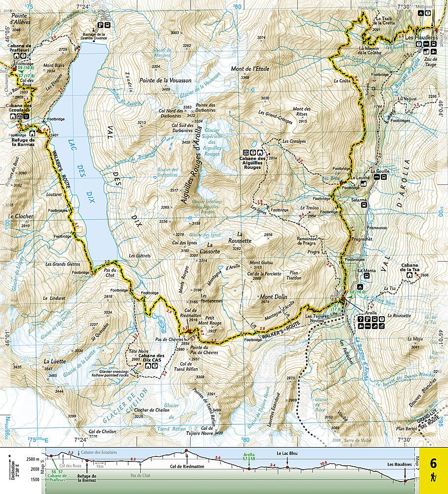
Haute Route, Chamonix to Zermatt: Map #4001
Couldn't load pickup availability
National Geographic Trails Illustrated Haute Route Chamonix to Zermatt Map #4001 — waterproof, tear-resistant. Complete coverage of the classic Haute Route alpine trek from Chamonix, France to Zermatt, Switzerland including hut locations, alternative routes, and high pass crossings. GPS-compatible.
The National Geographic Trails Illustrated Haute Route Map covers the full classic Haute Route from Chamonix to Zermatt — the high-level alpine trek crossing the French and Swiss Alps via glaciers, high passes, and mountain huts. Hut locations, alternative route options, high pass crossings, and GPS coordinates are mapped in detail.
Key specs
- SKU: NGTI4001
- Map number: 4001
- Coverage: Haute Route, Chamonix (France) to Zermatt (Switzerland)
- Material: Waterproof, tear-resistant paper
- Features: Full route, hut locations, alternative routes, high pass crossings, glacier terrain, GPS coordinates
Why it works
The Haute Route is one of the world's great alpine treks, crossing high passes and glaciers between two of the Alps' most iconic mountain towns — accurate hut location and alternative route detail is essential for planning the multi-day itinerary and adapting to weather conditions. The route's glacier crossings and high-altitude terrain require detailed topographic mapping for safe navigation. Waterproof construction is essential in the Alps where afternoon thunderstorms and glacier travel constantly expose maps to moisture.
Ideal for
Trekkers, mountaineers, and alpine hikers completing the classic Haute Route between Chamonix and Zermatt in the French and Swiss Alps.
Share