National Geographic
Adventure Map: United States Southeast
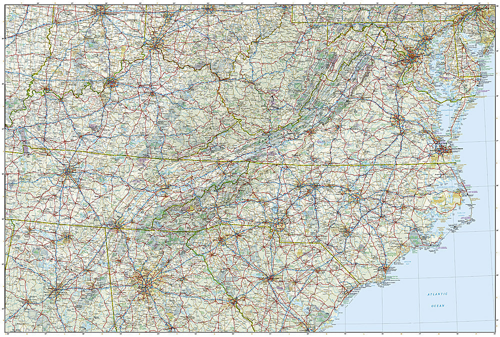
Adventure Map: United States Southeast
Couldn't load pickup availability
Waterproof, tear-resistant adventure map of the US Southeast — topography, roads, trails, national parks, Appalachians, and points of interest.
The National Geographic Adventure Map of the United States Southeast (3126) covers the southeastern states with accurate topography, road networks, national parks, Appalachian Trail corridor, Blue Ridge Parkway, and points of interest. Great Smoky Mountains, Shenandoah, Congaree, and the Atlantic coast are all covered. Printed on waterproof, tear-resistant synthetic paper.
Key specs:
- SKU: NGAM3126
- Material: Waterproof, tear-resistant synthetic paper
- Folded size: 4.25" x 9.25"
- Open size: 26" x 38"
- Two-sided print with comprehensive place name index
Why it works:
The US Southeast combines the Appalachian Mountains, Blue Ridge Parkway, Great Smoky Mountains, and Atlantic coastline into one of America's most diverse road trip regions. This map covers the full region with the road and park detail needed for planning and navigating road trips, hiking, and outdoor adventure across the Southeast.
Ideal for: Road trippers, hikers, and adventure travelers exploring the Southeast's national parks, Appalachian Trail, Blue Ridge Parkway, and coastlines.
Share