National Geographic
Adventure Map: Puerto Rico
Adventure Map: Puerto Rico
Couldn't load pickup availability
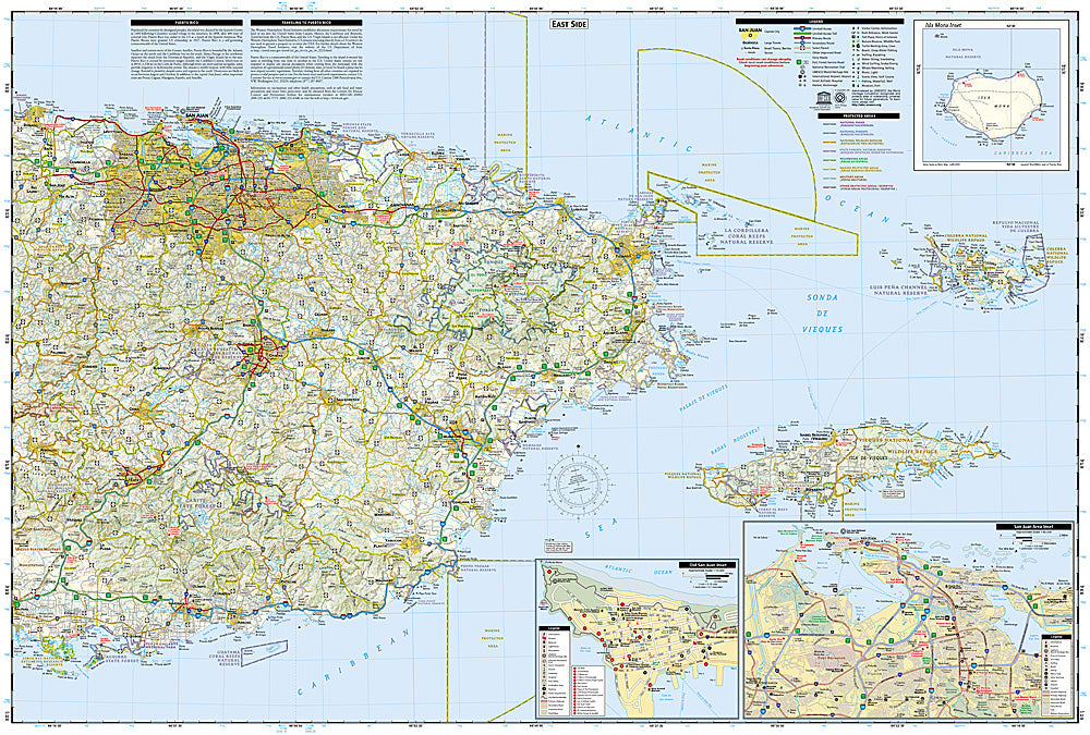
Waterproof, tear-resistant adventure map of Puerto Rico — topography, roads, trails, El Yunque, national parks, and points of interest.
The National Geographic Adventure Map of Puerto Rico (3107) covers the island including El Yunque National Forest, the Cordillera Central, Bioluminescent Bays, and road network with accurate topography and points of interest. Printed on waterproof, tear-resistant synthetic paper built for tropical conditions.
Key specs:
- SKU: NGAM3107
- Material: Waterproof, tear-resistant synthetic paper
- Folded size: 4.25" x 9.25"
- Open size: 26" x 38"
- Two-sided print with comprehensive place name index
Why it works:
Puerto Rico extends well beyond San Juan and the resort beaches — El Yunque is the only tropical rainforest in the US National Forest system, the Cordillera Central has hiking and coffee plantations, and the island's bioluminescent bays are among the world's brightest. This map covers the full island with the road and trail detail needed for independent exploration.
Ideal for: Hikers, road trippers, and adventure travelers exploring Puerto Rico's El Yunque, Cordillera Central, bioluminescent bays, and natural landmarks.
Share