National Geographic
Adventure Map: Canada West
Adventure Map: Canada West
Couldn't load pickup availability
Waterproof, tear-resistant adventure map of Western Canada — topography, roads, national parks, mountains, and points of interest.
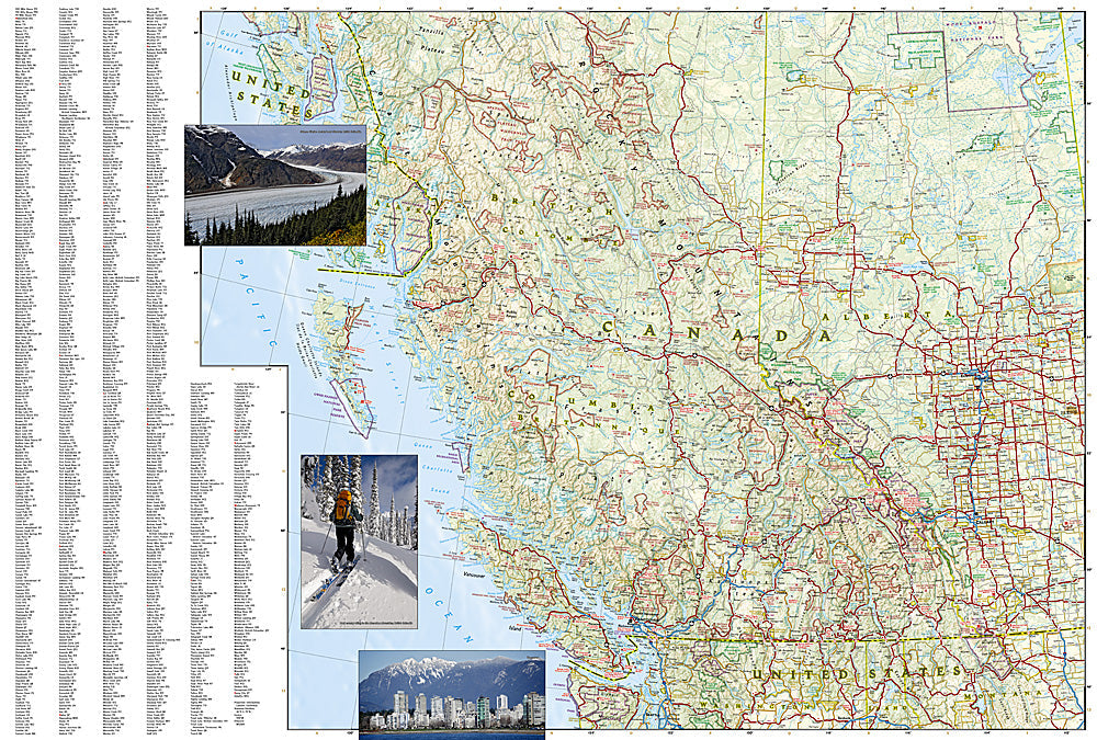
The National Geographic Adventure Map of Canada West (3113) covers British Columbia and Alberta with accurate topography, road networks, national and provincial parks, mountain ranges, and points of interest. Banff, Jasper, Yoho, Kootenay, and the Coast Mountains are all covered. Printed on waterproof, tear-resistant synthetic paper.
Key specs:
- SKU: NGAM3113
- Material: Waterproof, tear-resistant synthetic paper
- Folded size: 4.25" x 9.25"
- Open size: 26" x 38"
- Two-sided print with comprehensive place name index
Why it works:
Western Canada contains some of North America's most spectacular mountain and wilderness terrain — the Canadian Rockies, Coast Mountains, and Interior Plateau all reward travelers who can navigate beyond the main highways. This map covers the full region with the road and park detail needed for road trips, hiking, and outdoor adventure across BC and Alberta.
Ideal for: Road trippers, hikers, campers, and adventure travelers exploring Western Canada's national parks, mountain ranges, and wilderness areas.
Share