National Geographic
Adventure Map: Vietnam North
Adventure Map: Vietnam North
Couldn't load pickup availability
Waterproof, tear-resistant adventure map of North Vietnam — topography, roads, trails, Ha Long Bay, Sapa, national parks, and points of interest.
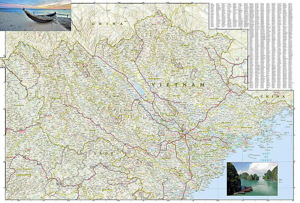
The National Geographic Adventure Map of Vietnam North (3015) covers Hanoi, Ha Long Bay, Sapa and the northern highlands, Ninh Binh, and the northern coast with accurate topography, road networks, national parks, and points of interest. Printed on waterproof, tear-resistant synthetic paper built for tropical conditions.
Key specs:
- SKU: NGAM3015
- Material: Waterproof, tear-resistant synthetic paper
- Folded size: 4.25" x 9.25"
- Open size: 26" x 38"
- Two-sided print with comprehensive place name index
Why it works:
North Vietnam's geography ranges from Ha Long Bay's karst seascape to Sapa's terraced rice fields and Hoang Lien Son mountains to the Red River Delta. Navigating between Hanoi, the northern highlands, and Ha Long Bay requires accurate mapping of roads and terrain. Waterproof construction survives Vietnam's monsoon season and tropical humidity.
Ideal for: Road trippers, trekkers, motorcyclists, and adventure travelers exploring North Vietnam's highlands, Ha Long Bay, and national parks.
Share