National Geographic
Adventure Map: Rocky Mountains
Adventure Map: Rocky Mountains
Couldn't load pickup availability
Waterproof, tear-resistant adventure map of the Rocky Mountains — topography, roads, trails, national parks, and points of interest.
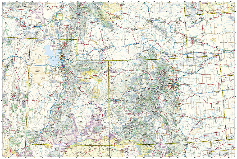
The National Geographic Adventure Map of the Rocky Mountains (3120) covers the Rockies from Montana and Idaho through Wyoming, Colorado, and into New Mexico with accurate topography, road networks, national parks, wilderness areas, and points of interest. Yellowstone, Grand Teton, Rocky Mountain NP, and Glacier are all covered. Printed on waterproof, tear-resistant synthetic paper.
Key specs:
- SKU: NGAM3120
- Material: Waterproof, tear-resistant synthetic paper
- Folded size: 4.25" x 9.25"
- Open size: 26" x 38"
- Two-sided print with comprehensive place name index
Why it works:
The Rocky Mountain region spans multiple states with some of America's most spectacular mountain terrain and highest concentration of national parks. This map covers the full range with the road and park detail needed for planning and navigating road trips, hiking, and outdoor adventure across the entire Rocky Mountain corridor.
Ideal for: Road trippers, hikers, campers, and adventure travelers exploring the Rocky Mountains' national parks, wilderness areas, and scenic byways.
Share