National Geographic
Adventure Map: United States Northeast
Adventure Map: United States Northeast
Couldn't load pickup availability
Waterproof, tear-resistant adventure map of the US Northeast — topography, roads, trails, national parks, Appalachians, and points of interest.
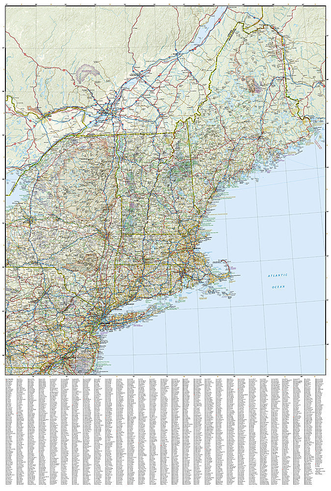
The National Geographic Adventure Map of the Northeast (3127) covers New England and the Mid-Atlantic states with accurate topography, road networks, national parks, Appalachian Trail corridor, White Mountains, Adirondacks, and points of interest. Printed on waterproof, tear-resistant synthetic paper.
Key specs:
- SKU: NGAM3127
- Material: Waterproof, tear-resistant synthetic paper
- Folded size: 4.25" x 9.25"
- Open size: 26" x 38"
- Two-sided print with comprehensive place name index
Why it works:
The US Northeast packs extraordinary outdoor diversity into a compact region — the White Mountains, Adirondacks, Acadia, Delaware Water Gap, and the northern Appalachian Trail all within a day's drive of major population centers. This map covers the full region with the road and trail detail needed for road trips, hiking, and outdoor adventure across New England and the Mid-Atlantic.
Ideal for: Road trippers, hikers, leaf-peepers, and adventure travelers exploring the Northeast's national parks, White Mountains, Adirondacks, and Appalachian Trail.
Share