National Geographic
Adventure Map: Alaska
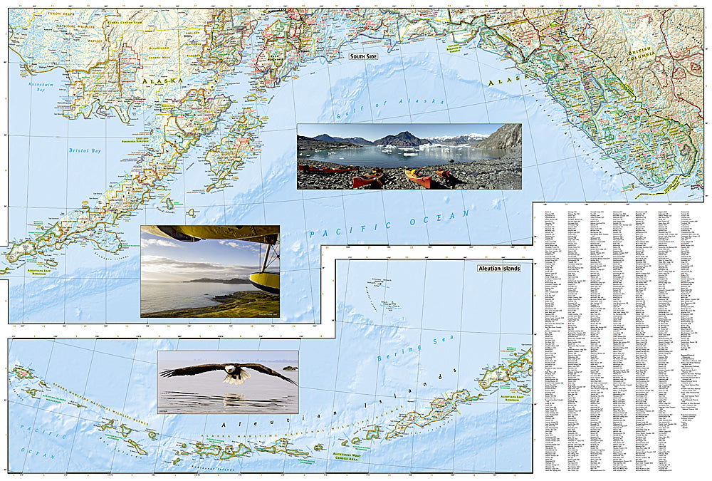
Adventure Map: Alaska
Couldn't load pickup availability
Waterproof, tear-resistant adventure map of Alaska — topography, roads, trails, national parks, wilderness areas, and points of interest.
The National Geographic Adventure Map of Alaska (3117) covers the full state with accurate topography, road networks, national parks, wilderness areas, the Alaska Highway, and points of interest. Denali, Wrangell-St. Elias, Kenai Fjords, Glacier Bay, and the Inside Passage are all covered. Printed on waterproof, tear-resistant synthetic paper.
Key specs:
- SKU: NGAM3117
- Material: Waterproof, tear-resistant synthetic paper
- Folded size: 4.25" x 9.25"
- Open size: 26" x 38"
- Two-sided print with comprehensive place name index
Why it works:
Alaska is the largest US state with vast stretches of roadless wilderness — understanding the road network, ferry system, and geographic relationships between Anchorage, Fairbanks, the Kenai Peninsula, and the national parks is essential for planning any Alaska trip. This map provides the big-picture orientation needed for navigating the Last Frontier.
Ideal for: Road trippers, backpackers, anglers, hunters, and adventure travelers exploring Alaska's national parks, wilderness areas, and remote regions.
Share