National Geographic
Adventure Map: Uruguay & Paraguay
Adventure Map: Uruguay & Paraguay
Couldn't load pickup availability
Waterproof, tear-resistant adventure map of Uruguay & Paraguay — topography, roads, rivers, national parks, and points of interest.
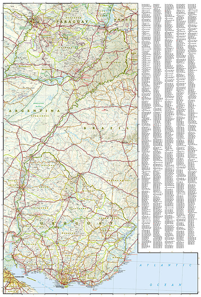
The National Geographic Adventure Map of Uruguay & Paraguay (3407) covers both countries with accurate topography, road networks, river systems, national parks, and points of interest. Uruguay's Atlantic coast and rolling grasslands, and Paraguay's Gran Chaco and Pantanal border regions are all covered. Printed on waterproof, tear-resistant synthetic paper.
Key specs:
- SKU: NGAM3407
- Material: Waterproof, tear-resistant synthetic paper
- Folded size: 4.25" x 9.25"
- Open size: 26" x 38"
- Two-sided print with comprehensive place name index
Why it works:
Uruguay and Paraguay are two of South America's most overlooked destinations — Uruguay for its Atlantic beaches and gaucho culture, Paraguay for the Gran Chaco wilderness and Jesuit mission ruins. This map covers both countries with the road and terrain detail needed for independent travel and overland exploration.
Ideal for: Road trippers, overlanders, and adventure travelers exploring Uruguay's coast and Paraguay's Gran Chaco and interior regions.
Share