National Geographic
Adventure Map: Tuscany
Adventure Map: Tuscany
Couldn't load pickup availability
Waterproof, tear-resistant adventure map of Tuscany — topography, roads, trails, national parks, hill towns, and points of interest.
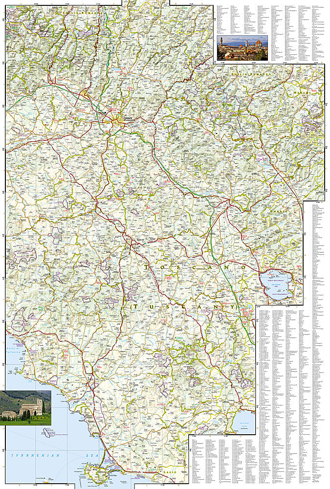
The National Geographic Adventure Map of Tuscany (3305) covers the region including the Chianti hills, Val d'Orcia, Maremma, Apuan Alps, and Tuscan Archipelago with accurate topography, road networks, hiking trails, and points of interest. Printed on waterproof, tear-resistant synthetic paper.
Key specs:
- SKU: NGAM3305
- Material: Waterproof, tear-resistant synthetic paper
- Folded size: 4.25" x 9.25"
- Open size: 26" x 38"
- Two-sided print with comprehensive place name index
Why it works:
Tuscany's network of white gravel roads — the famous strade bianche — connects hill towns, vineyards, and cypress-lined landscapes that reward cyclists and road trippers who venture off the main highways. This map covers the full region with the road and trail detail needed for navigating Tuscany's scenic byways, hiking trails, and national parks.
Ideal for: Road trippers, cyclists, hikers, and adventure travelers exploring Tuscany's hill towns, Chianti wine country, Val d'Orcia, and national parks.
Share