National Geographic
Adventure Map: Philippines
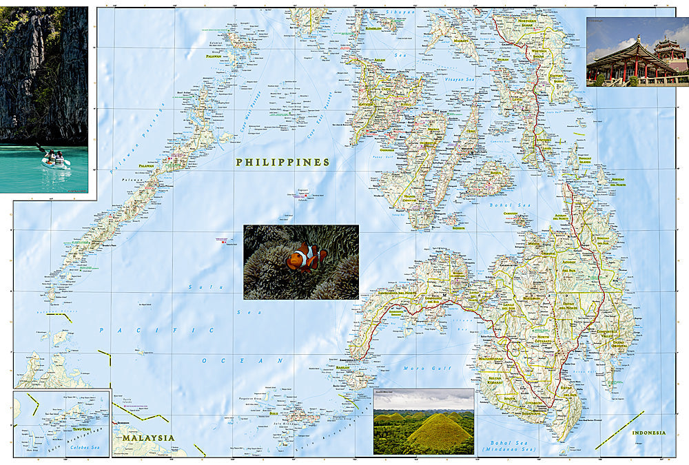
Adventure Map: Philippines
Couldn't load pickup availability
Waterproof, tear-resistant adventure map of the Philippines — topography, roads, islands, national parks, dive sites, and points of interest.
The National Geographic Adventure Map of the Philippines (3022) covers the archipelago's major islands — Luzon, Visayas, and Mindanao — with accurate topography, road networks, national parks, dive sites, and points of interest. Printed on waterproof, tear-resistant synthetic paper built for tropical conditions.
Key specs:
- SKU: NGAM3022
- Material: Waterproof, tear-resistant synthetic paper
- Folded size: 4.25" x 9.25"
- Open size: 26" x 38"
- Two-sided print with comprehensive place name index
Why it works:
The Philippines comprises over 7,600 islands, making navigation between Palawan, the Visayas, Luzon, and Mindanao complex without accurate mapping. This map covers the major island groups with the road network, ferry routes, and terrain detail needed for island hopping and independent travel across the archipelago.
Ideal for: Divers, island hoppers, backpackers, and adventure travelers exploring the Philippines' national parks, dive sites, and island destinations.
Share