National Geographic
Adventure Map: Northern Yucatan
Adventure Map: Northern Yucatan
Couldn't load pickup availability
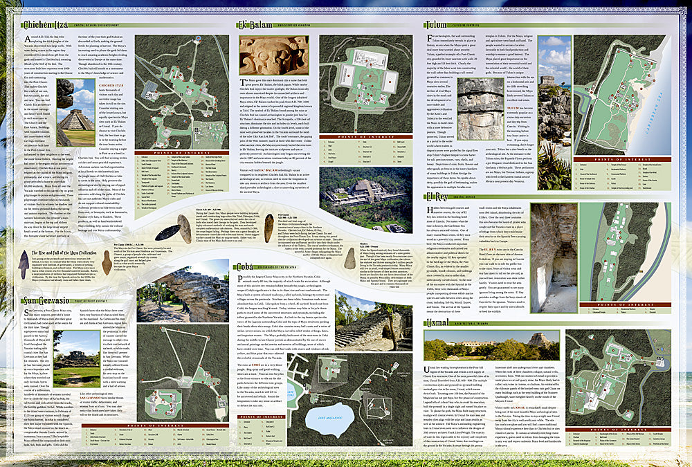
Waterproof, tear-resistant adventure map of Northern Yucatan — topography, roads, trails, Maya sites, cenotes, and points of interest.
The National Geographic Adventure Map of Northern Yucatan (3105) covers the Yucatan Peninsula including Chichen Itza, Uxmal, the Riviera Maya, Merida, and the cenote network with accurate topography, road networks, and points of interest. Printed on waterproof, tear-resistant synthetic paper built for tropical conditions.
Key specs:
- SKU: NGAM3105
- Material: Waterproof, tear-resistant synthetic paper
- Folded size: 4.25" x 9.25"
- Open size: 26" x 38"
- Two-sided print with comprehensive place name index
Why it works:
The Yucatan Peninsula's flat limestone terrain hides an extraordinary network of cenotes, underground rivers, and Maya archaeological sites that extend far beyond the Riviera Maya resort corridor. This map covers the full northern Yucatan with the road and site detail needed for exploring Chichen Itza, Uxmal, Merida, and the cenote network independently.
Ideal for: History enthusiasts, divers, road trippers, and adventure travelers exploring the Yucatan's Maya sites, cenotes, and colonial cities.
Share