National Geographic
Adventure Map: Nicaragua, Honduras & El Salvador
Adventure Map: Nicaragua, Honduras & El Salvador
Couldn't load pickup availability
Waterproof, tear-resistant adventure map of Nicaragua, Honduras & El Salvador — topography, roads, trails, volcanoes, national parks, and points of interest.
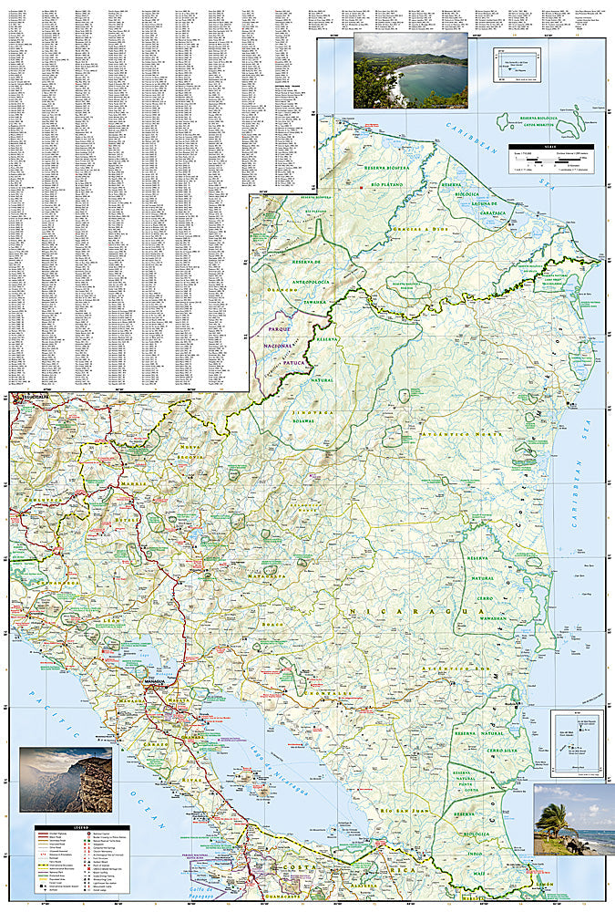
The National Geographic Adventure Map of Nicaragua, Honduras & El Salvador (3109) covers all three Central American nations with accurate topography, road networks, national parks, volcanoes, Caribbean and Pacific coasts, and points of interest. Printed on waterproof, tear-resistant synthetic paper.
Key specs:
- SKU: NGAM3109
- Material: Waterproof, tear-resistant synthetic paper
- Folded size: 4.25" x 9.25"
- Open size: 26" x 38"
- Two-sided print with comprehensive place name index
Why it works:
These three Central American countries are increasingly popular with adventure travelers — Nicaragua's colonial cities and volcano boarding, Honduras's Bay Islands diving and Copan Maya ruins, and El Salvador's surf breaks and national parks. This map covers all three countries with the road and terrain detail needed for overland travel and independent exploration.
Ideal for: Overlanders, backpackers, surfers, divers, and adventure travelers exploring Nicaragua, Honduras, and El Salvador's national parks, coastlines, and cultural sites.
Share