National Geographic
Adventure Map: Morocco
Adventure Map: Morocco
Couldn't load pickup availability
Waterproof, tear-resistant adventure map of Morocco — topography, roads, trails, Atlas Mountains, Sahara, and points of interest.
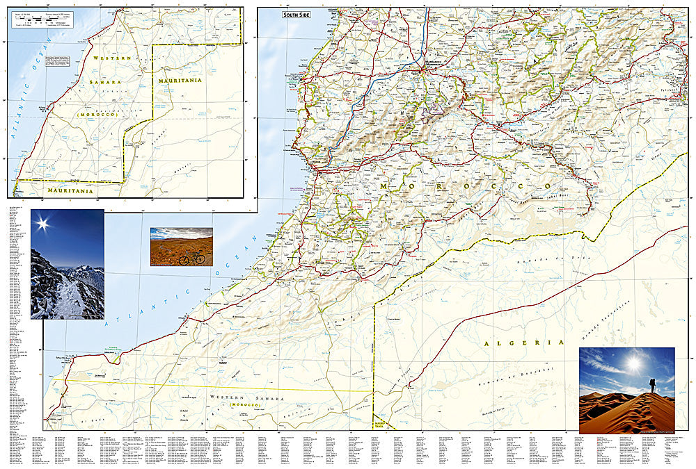
The National Geographic Adventure Map of Morocco (3203) covers the country including the High Atlas, Anti-Atlas, Sahara Desert, Atlantic and Mediterranean coasts, and imperial cities with accurate topography, road networks, and points of interest. Printed on waterproof, tear-resistant synthetic paper.
Key specs:
- SKU: NGAM3203
- Material: Waterproof, tear-resistant synthetic paper
- Folded size: 4.25" x 9.25"
- Open size: 26" x 38"
- Two-sided print with comprehensive place name index
Why it works:
Morocco's geography ranges from the High Atlas peaks — including Toubkal, North Africa's highest mountain — to the Sahara dunes of Merzouga and the Atlantic surf coast. Navigating between Marrakech, the Atlas passes, the Draa Valley, and the Sahara requires accurate mapping of roads and terrain, especially on piste tracks where connectivity is unreliable.
Ideal for: Trekkers on Toubkal, road trippers, overlanders, and adventure travelers exploring Morocco's Atlas Mountains, Sahara, and imperial cities.
Share