National Geographic
Adventure Map: Mexico
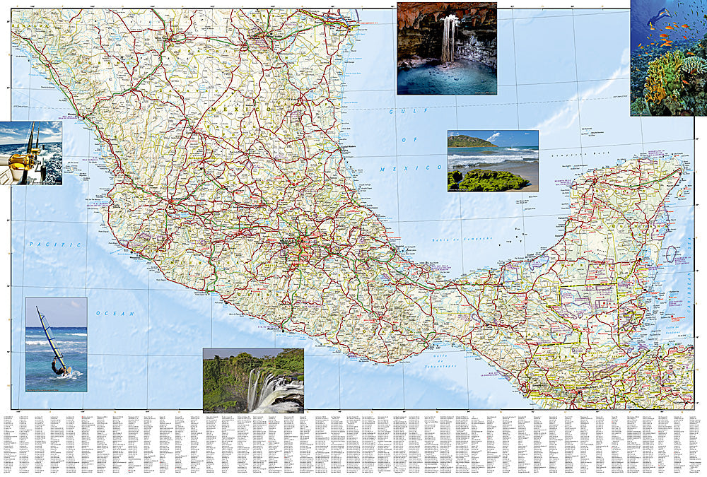
Adventure Map: Mexico
Couldn't load pickup availability
Waterproof, tear-resistant adventure map of Mexico — topography, roads, trails, national parks, Maya and Aztec sites, and points of interest.
The National Geographic Adventure Map of Mexico (3108) covers the full country with accurate topography, road networks, national parks, archaeological sites, and points of interest — from Baja California and the Copper Canyon to the Yucatan Peninsula and Chiapas. Printed on waterproof, tear-resistant synthetic paper.
Key specs:
- SKU: NGAM3108
- Material: Waterproof, tear-resistant synthetic paper
- Folded size: 4.25" x 9.25"
- Open size: 26" x 38"
- Two-sided print with comprehensive place name index
Why it works:
Mexico is a vast country with dramatically varied terrain — desert, jungle, mountains, and thousands of miles of coastline on two oceans. Navigating between the Copper Canyon, Oaxaca, Chiapas, and the Yucatan requires accurate mapping of roads and terrain across regions where connectivity is unreliable. Waterproof construction survives Mexico's tropical humidity and rain.
Ideal for: Road trippers, overlanders, backpackers, and adventure travelers exploring Mexico's national parks, archaeological sites, and diverse landscapes.
Share