National Geographic
Adventure Map: Jamaica
Adventure Map: Jamaica
Couldn't load pickup availability
Waterproof, tear-resistant adventure map of Jamaica — topography, roads, trails, Blue Mountains, national parks, and points of interest.
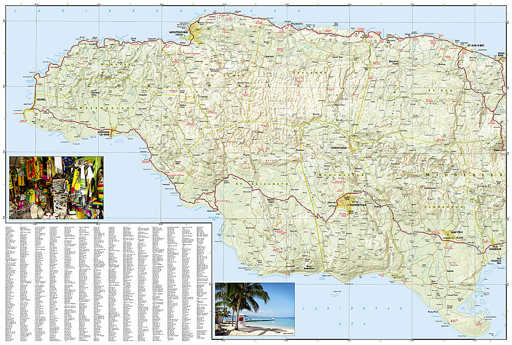
The National Geographic Adventure Map of Jamaica (3116) covers the island including the Blue Mountains, Cockpit Country, north and south coasts, and road network with accurate topography and points of interest. Printed on waterproof, tear-resistant synthetic paper built for Caribbean conditions.
Key specs:
- SKU: NGAM3116
- Material: Waterproof, tear-resistant synthetic paper
- Folded size: 4.25" x 9.25"
- Open size: 26" x 38"
- Two-sided print with comprehensive place name index
Why it works:
Jamaica extends well beyond its resort beaches — the Blue Mountains offer exceptional hiking and coffee plantation tours, the Cockpit Country is one of the Caribbean's most biodiverse regions, and the island's interior has waterfalls, rivers, and cultural sites that reward independent travelers. This map covers the full island with the road and terrain detail needed for exploring beyond the tourist areas.
Ideal for: Hikers, road trippers, and adventure travelers exploring Jamaica's Blue Mountains, interior regions, and natural landmarks beyond the resort areas.
Share