National Geographic
Adventure Map: Crete
Adventure Map: Crete
Couldn't load pickup availability
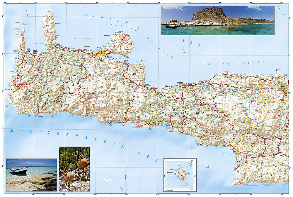
Waterproof, tear-resistant adventure map of Crete — topography, roads, trails, gorges, and coastal points of interest.
The National Geographic Adventure Map of Crete (3317) covers Greece's largest island with accurate topography, road networks, hiking trails, the Samaria Gorge and other gorge routes, archaeological sites, and coastal points of interest. Printed on waterproof, tear-resistant synthetic paper.
Key specs:
- SKU: NGAM3317
- Material: Waterproof, tear-resistant synthetic paper
- Folded size: 4.25" x 9.25"
- Open size: 26" x 38"
- Two-sided print with comprehensive place name index
Why it works:
Crete is large enough and varied enough that a detailed map is essential for exploring beyond the resort areas — the White Mountains, Samaria Gorge, Minoan archaeological sites, and remote south coast villages all reward travelers who can navigate the island's interior road network and trail system.
Ideal for: Hikers, road trippers, history enthusiasts, and adventure travelers exploring Crete's mountains, gorges, archaeological sites, and coastline.
Share