National Geographic
Adventure Map: Hawaii
Adventure Map: Hawaii
Couldn't load pickup availability
Waterproof, tear-resistant adventure map of Hawaii — topography, roads, trails, national parks, volcanoes, and points of interest across all major islands.
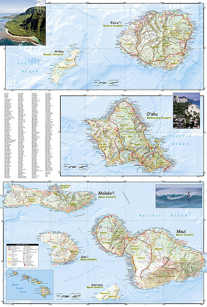
The National Geographic Adventure Map of Hawaii (3111) covers the major Hawaiian Islands — Oahu, Maui, Hawaii (Big Island), Kauai, Molokai, and Lanai — with accurate topography, road networks, national parks, hiking trails, and points of interest. Printed on waterproof, tear-resistant synthetic paper.
Key specs:
- SKU: NGAM3111
- Material: Waterproof, tear-resistant synthetic paper
- Folded size: 4.25" x 9.25"
- Open size: 26" x 38"
- Two-sided print with comprehensive place name index
Why it works:
Hawaii's islands each have distinct terrain and road networks — from the Big Island's active volcanoes and Mauna Kea summit to Kauai's Na Pali Coast and Waimea Canyon. This map covers all major islands with the trail and road detail needed for hiking, driving, and exploring beyond the resort areas.
Ideal for: Hikers, road trippers, and adventure travelers exploring Hawaii's national parks, volcanoes, trails, and natural landmarks across the major islands.
Share