National Geographic
Adventure Map: Guatemala
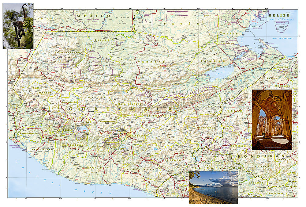
Adventure Map: Guatemala
Couldn't load pickup availability
Waterproof, tear-resistant adventure map of Guatemala — topography, roads, trails, volcanoes, Maya sites, and national parks.
The National Geographic Adventure Map of Guatemala (3110) covers the country's volcanic highlands, Lake Atitlán, Tikal and other Maya archaeological sites, Pacific coast, and Caribbean lowlands with accurate topography, road networks, and points of interest. Printed on waterproof, tear-resistant synthetic paper.
Key specs:
- SKU: NGAM3110
- Material: Waterproof, tear-resistant synthetic paper
- Folded size: 4.25" x 9.25"
- Open size: 26" x 38"
- Two-sided print with comprehensive place name index
Why it works:
Guatemala packs extraordinary diversity into a small country — active volcanoes, colonial Antigua, Lake Atitlán, and the Tikal jungle ruins are all within reach of each other. This map covers the full country with the road and terrain detail needed for navigating between these destinations and exploring Guatemala's highland villages and remote regions.
Ideal for: Trekkers, road trippers, history enthusiasts, and adventure travelers exploring Guatemala's volcanoes, Maya sites, and highland regions.
Share