National Geographic
Adventure Map: Everest Base Camp
Adventure Map: Everest Base Camp
Couldn't load pickup availability
Waterproof, tear-resistant topographic map of the Everest region — trails, villages, teahouses, passes, and high-altitude terrain for the Everest Base Camp trek.
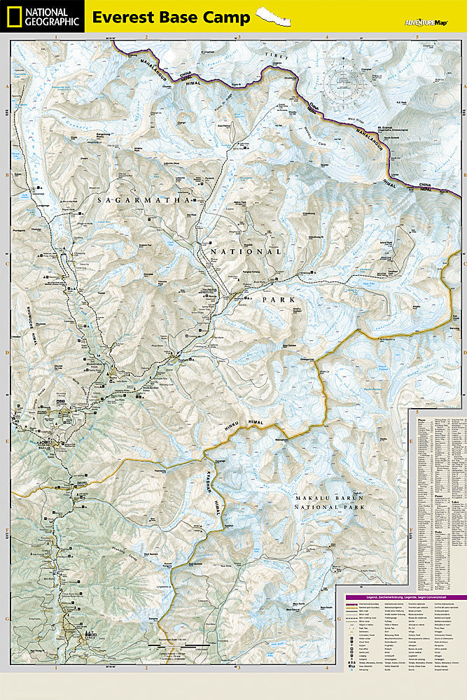
The National Geographic Adventure Map of Everest Base Camp (3001) covers the Khumbu region of Nepal including the Everest Base Camp trail, Namche Bazaar, Tengboche, Dingboche, Lobuche, and surrounding high-altitude terrain with detailed topography, trail networks, villages, and teahouses. Printed on waterproof, tear-resistant synthetic paper essential for Himalayan conditions.
Key specs:
- SKU: NGAM3001
- Material: Waterproof, tear-resistant synthetic paper
- Folded size: 4.25" x 9.25"
- Open size: 26" x 38"
- Two-sided print with comprehensive place name index
Why it works:
The Everest Base Camp trek is one of the world's most iconic high-altitude routes, reaching 17,598 feet at Base Camp. Accurate topographic mapping of trails, villages, teahouses, and altitude is essential for safe navigation and acclimatization planning in this extreme environment. Waterproof construction survives the snow, rain, and humidity of Himalayan trekking.
Ideal for: Trekkers completing the Everest Base Camp route and other trails in Nepal's Khumbu region, including the Three Passes Trek and Gokyo Lakes route.
Share