National Geographic
Adventure Map: Egypt
Adventure Map: Egypt
Couldn't load pickup availability
Waterproof, tear-resistant adventure map of Egypt — topography, roads, trails, Nile Valley, Sinai, and points of interest.
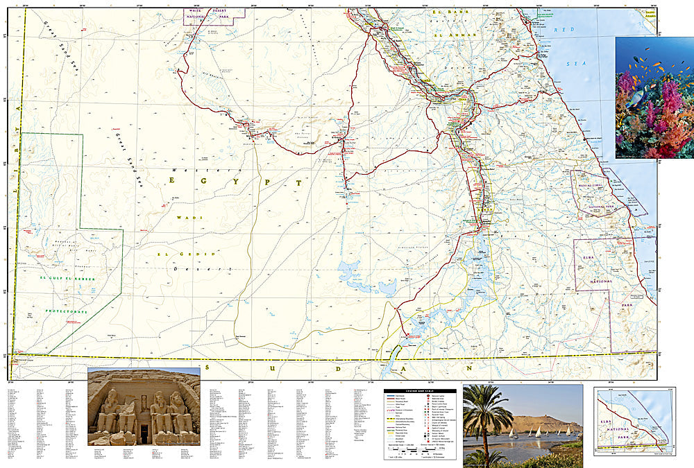
The National Geographic Adventure Map of Egypt (3202) covers the Nile Valley, Cairo, Luxor, Aswan, the Sinai Peninsula, Red Sea coast, and Western Desert with accurate topography, road networks, and points of interest. Printed on waterproof, tear-resistant synthetic paper.
Key specs:
- SKU: NGAM3202
- Material: Waterproof, tear-resistant synthetic paper
- Folded size: 4.25" x 9.25"
- Open size: 26" x 38"
- Two-sided print with comprehensive place name index
Why it works:
Egypt's geography extends far beyond the Nile Valley — the Sinai Peninsula has exceptional diving and trekking, the Western Desert has remote oases and sand seas, and the Red Sea coast has world-class dive sites. This map covers the full country with the road and terrain detail needed for exploring beyond the standard tourist circuit.
Ideal for: History enthusiasts, divers, trekkers, and adventure travelers exploring Egypt's ancient sites, Sinai Peninsula, Red Sea coast, and Western Desert.
Share