National Geographic
Adventure Map: Dominican Republic
Adventure Map: Dominican Republic
Couldn't load pickup availability
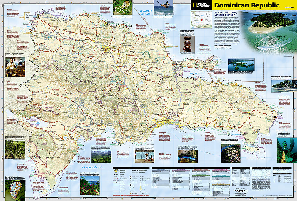
Waterproof, tear-resistant adventure map of the Dominican Republic — topography, roads, trails, national parks, mountains, and points of interest.
The National Geographic Adventure Map of the Dominican Republic (3102) covers the island including Pico Duarte and the Cordillera Central, Los Haitises National Park, Jaragua National Park, and the north and south coasts with accurate topography, road networks, and points of interest. Printed on waterproof, tear-resistant synthetic paper.
Key specs:
- SKU: NGAM3102
- Material: Waterproof, tear-resistant synthetic paper
- Folded size: 4.25" x 9.25"
- Open size: 26" x 38"
- Two-sided print with comprehensive place name index
Why it works:
The Dominican Republic extends well beyond Punta Cana's resort beaches — Pico Duarte is the highest peak in the Caribbean, Los Haitises has mangroves and cave paintings, and the Cordillera Central offers hiking and waterfalls. This map covers the full country with the road and terrain detail needed for independent exploration beyond the resort areas.
Ideal for: Hikers, road trippers, and adventure travelers exploring the Dominican Republic's mountains, national parks, and natural landmarks beyond the resort areas.
Share