National Geographic
Adventure Map: Cuba
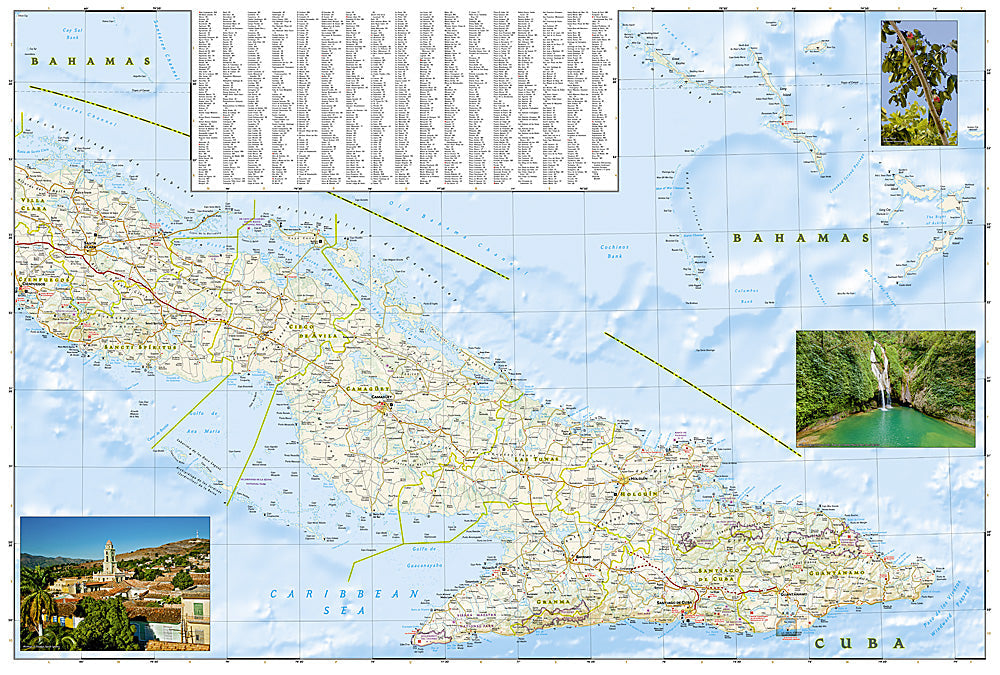
Adventure Map: Cuba
Couldn't load pickup availability
Waterproof, tear-resistant adventure map of Cuba — topography, roads, trails, national parks, and points of interest.
The National Geographic Adventure Map of Cuba (3112) covers the island from Havana and Viñales in the west to Trinidad, Cienfuegos, and Santiago de Cuba in the east with accurate topography, road networks, national parks, and points of interest. Printed on waterproof, tear-resistant synthetic paper.
Key specs:
- SKU: NGAM3112
- Material: Waterproof, tear-resistant synthetic paper
- Folded size: 4.25" x 9.25"
- Open size: 26" x 38"
- Two-sided print with comprehensive place name index
Why it works:
Cuba's road network and signage can be challenging to navigate, and reliable digital maps are not always available on the island. A detailed printed map covering roads, towns, national parks, and points of interest is an essential tool for independent travel across Cuba's diverse regions — from the tobacco valleys of Viñales to the colonial streets of Trinidad.
Ideal for: Independent travelers, road trippers, cyclists, and adventure travelers exploring Cuba's colonial cities, national parks, and countryside.
Share