National Geographic
Adventure Map: Croatia
Adventure Map: Croatia
Couldn't load pickup availability
Waterproof, tear-resistant adventure map of Croatia — topography, roads, trails, Adriatic coast, islands, and national parks.
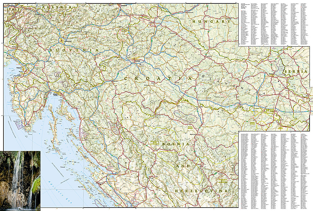
The National Geographic Adventure Map of Croatia (3324) covers the Dalmatian Coast, Istrian Peninsula, Plitvice Lakes, Krka National Park, and the Adriatic islands with accurate topography, road networks, ferry routes, hiking trails, and points of interest. Printed on waterproof, tear-resistant synthetic paper.
Key specs:
- SKU: NGAM3324
- Material: Waterproof, tear-resistant synthetic paper
- Folded size: 4.25" x 9.25"
- Open size: 26" x 38"
- Two-sided print with comprehensive place name index
Why it works:
Croatia's coastline stretches over 1,000 miles with more than 1,200 islands, making navigation between coastal towns, ferry routes, and island destinations complex without a detailed map. This map covers the full country including ferry connections, national parks, and hiking trails for confident navigation on land and between islands.
Ideal for: Road trippers, sailors, hikers, and adventure travelers exploring Croatia's Dalmatian Coast, islands, and national parks.
Share