National Geographic
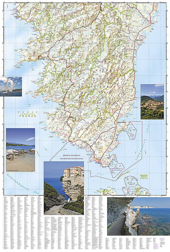
Adventure Map: Corsica
Adventure Map: Corsica
Couldn't load pickup availability
Waterproof, tear-resistant adventure map of Corsica — topography, roads, trails, GR20 route, and coastal points of interest.
The National Geographic Adventure Map of Corsica (3315) covers the island's rugged mountain interior, the famous GR20 long-distance trail, coastal routes, and key towns with accurate topography and detailed cartography. Printed on waterproof, tear-resistant synthetic paper.
Key specs:
- SKU: NGAM3315
- Material: Waterproof, tear-resistant synthetic paper
- Folded size: 4.25" x 9.25"
- Open size: 26" x 38"
- Two-sided print with comprehensive place name index
Why it works:
Corsica's GR20 is widely considered one of Europe's most challenging and rewarding long-distance trails, crossing the island's granite spine from north to south. This map covers the full island with the trail and terrain detail needed for hiking the GR20 or exploring Corsica's remote interior and dramatic coastline.
Ideal for: Hikers tackling the GR20, trekkers, road trippers, and adventure travelers exploring Corsica's mountains and coastline.
Share