National Geographic
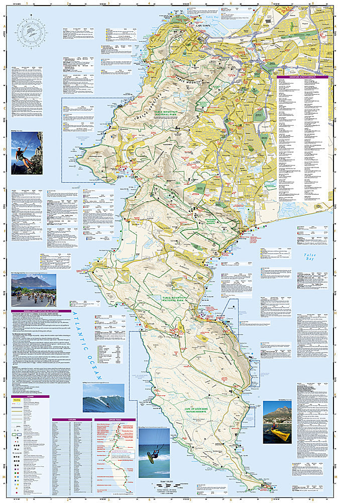
Adventure Map: Cape Town & Surrounds
Adventure Map: Cape Town & Surrounds
Couldn't load pickup availability
Waterproof, tear-resistant adventure map of Cape Town & Surrounds — topography, roads, trails, Table Mountain, Winelands, and points of interest.
The National Geographic Adventure Map of Cape Town & Surrounds (3200) covers the Cape Peninsula, Table Mountain National Park, Cape Winelands, Garden Route, and surrounding region with accurate topography, road networks, hiking trails, and points of interest. Printed on waterproof, tear-resistant synthetic paper.
Key specs:
- SKU: NGAM3200
- Material: Waterproof, tear-resistant synthetic paper
- Folded size: 4.25" x 9.25"
- Open size: 26" x 38"
- Two-sided print with comprehensive place name index
Why it works:
The Cape Town region packs extraordinary diversity into a compact area — Table Mountain's hiking trails, the Cape Peninsula's coastal scenery, the Winelands' scenic drives, and the Garden Route's forests and beaches are all within reach. This map covers the region with the road and trail detail needed for hiking, driving, and exploring the full Cape area.
Ideal for: Hikers, road trippers, wine travelers, and adventure travelers exploring Cape Town, Table Mountain, the Cape Peninsula, and the Garden Route.
Share