National Geographic
Adventure Map: Cambodia
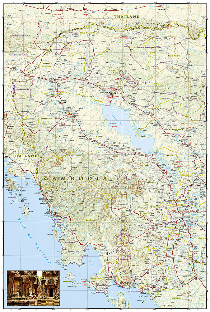
Adventure Map: Cambodia
Couldn't load pickup availability
Waterproof, tear-resistant adventure map of Cambodia — topography, roads, trails, Angkor Wat, national parks, and points of interest.
The National Geographic Adventure Map of Cambodia (3024) covers the country including Angkor Archaeological Park, Cardamom Mountains, Mekong River corridor, and Gulf of Thailand coast with accurate topography, road networks, and points of interest. Printed on waterproof, tear-resistant synthetic paper built for tropical conditions.
Key specs:
- SKU: NGAM3024
- Material: Waterproof, tear-resistant synthetic paper
- Folded size: 4.25" x 9.25"
- Open size: 26" x 38"
- Two-sided print with comprehensive place name index
Why it works:
Cambodia extends well beyond Angkor Wat — the Cardamom Mountains offer exceptional wildlife and trekking, the Mekong corridor has Irrawaddy dolphins and river communities, and the southern coast has underdeveloped beaches. This map covers the full country with the road and terrain detail needed for exploring beyond the main tourist circuit.
Ideal for: Backpackers, cultural travelers, eco-travelers, and adventure travelers exploring Cambodia's temples, national parks, and off-the-beaten-path regions.
Share