National Geographic
Adventure Map: Bolivia
Adventure Map: Bolivia
Couldn't load pickup availability
Waterproof, tear-resistant adventure map of Bolivia — topography, roads, trails, Altiplano, Amazon, and national parks.
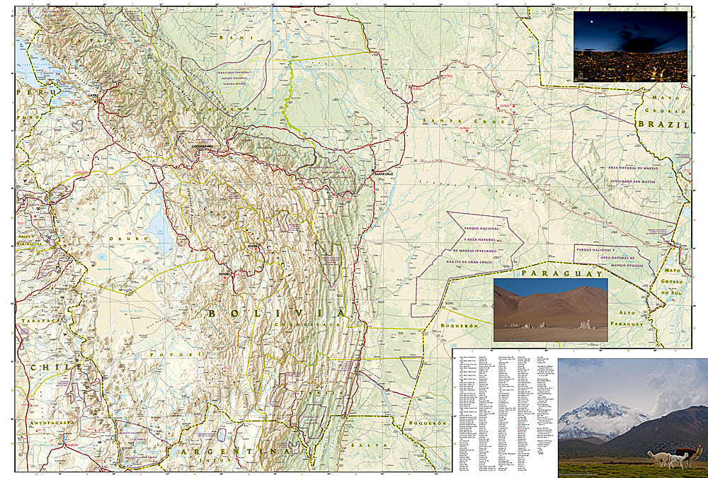
The National Geographic Adventure Map of Bolivia (3406) covers the country's dramatic terrain — the high Altiplano with Lake Titicaca and Salar de Uyuni, the Yungas cloud forests, and the Amazon lowlands — with accurate topography, road networks, national parks, and points of interest. Printed on waterproof, tear-resistant synthetic paper.
Key specs:
- SKU: NGAM3406
- Material: Waterproof, tear-resistant synthetic paper
- Folded size: 4.25" x 9.25"
- Open size: 26" x 38"
- Two-sided print with comprehensive place name index
Why it works:
Bolivia's road network ranges from paved highways to the infamous Death Road and remote Altiplano tracks. Accurate mapping is essential for navigating between the Salar de Uyuni, Lake Titicaca, Sucre, and the Amazon basin — especially in a country where connectivity is unreliable and road conditions change seasonally.
Ideal for: Trekkers, road trippers, overlanders, and adventure travelers exploring Bolivia's Altiplano, Salar de Uyuni, and Amazon regions.
Share