National Geographic
Adventure Map: Baja South
Adventure Map: Baja South
Couldn't load pickup availability
Waterproof, tear-resistant adventure map of Baja California South — topography, roads, trails, and coastal points of interest.
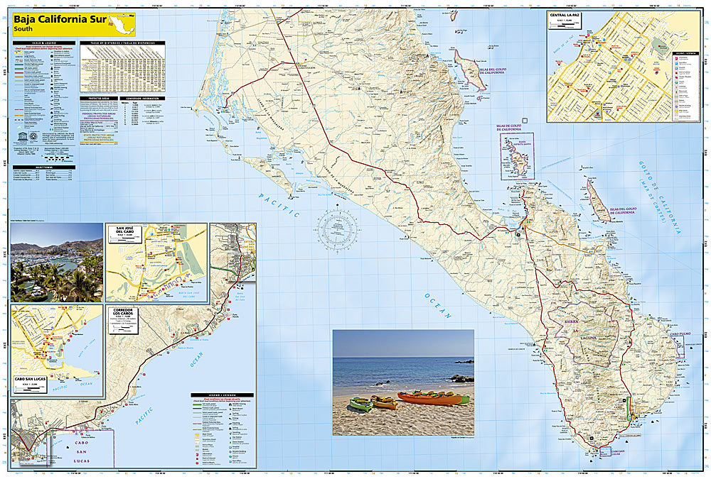
The National Geographic Adventure Map of Baja California South (3104) covers the southern half of the Baja Peninsula from the Vizcaino Desert south through La Paz, San José del Cabo, and Cabo San Lucas with accurate topography, road networks, trails, and points of interest. Printed on waterproof, tear-resistant synthetic paper.
Key specs:
- SKU: NGAM3104
- Material: Waterproof, tear-resistant synthetic paper
- Folded size: 4.25" x 9.25"
- Open size: 26" x 38"
- Two-sided print with comprehensive place name index
Why it works:
Southern Baja is one of Mexico's premier adventure destinations — whale watching in Magdalena Bay, kayaking in the Sea of Cortez, surfing the Pacific coast, and exploring the Sierra de la Laguna mountains. This map covers the road network and terrain in detail for confident navigation on both paved and dirt roads throughout the southern peninsula.
Ideal for: Road trippers, overlanders, surfers, kayakers, and adventure travelers exploring southern Baja California by vehicle or on foot.
Share