National Geographic
Adventure Map: Baja North
Adventure Map: Baja North
Couldn't load pickup availability
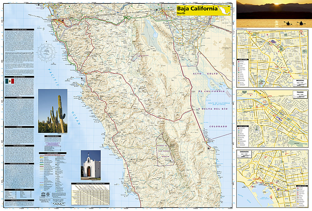
Waterproof, tear-resistant adventure map of Baja California North — topography, roads, trails, and coastal points of interest.
The National Geographic Adventure Map of Baja California North (3103) covers the northern half of the Baja Peninsula from Tijuana and Mexicali south through Ensenada and the Sierra de San Pedro Mártir with accurate topography, road networks, trails, and points of interest. Printed on waterproof, tear-resistant synthetic paper.
Key specs:
- SKU: NGAM3103
- Material: Waterproof, tear-resistant synthetic paper
- Folded size: 4.25" x 9.25"
- Open size: 26" x 38"
- Two-sided print with comprehensive place name index
Why it works:
Northern Baja is one of the most accessible adventure destinations from the US Southwest — wine country, Pacific surf breaks, desert camping, and the Sierra de San Pedro Mártir all within a day's drive of the border. This map covers the road network and terrain in detail for confident navigation on both paved and dirt roads.
Ideal for: Road trippers, overlanders, surfers, campers, and adventure travelers exploring northern Baja California by vehicle or on foot.
Share