National Geographic
Adventure Map: Annapurna
Adventure Map: Annapurna
Couldn't load pickup availability
Waterproof, tear-resistant topographic map of the Annapurna region — trails, villages, teahouses, passes, and high-altitude terrain.
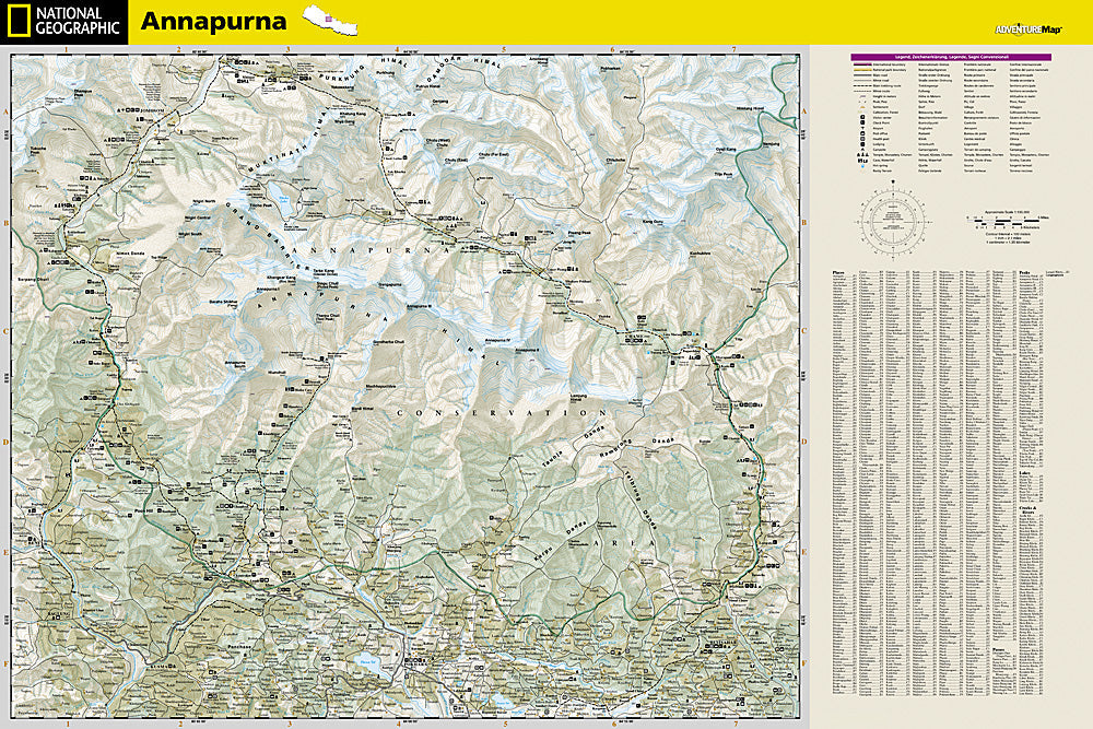
The National Geographic Adventure Map of Annapurna (3003) covers the Annapurna Circuit, Annapurna Sanctuary, and surrounding trekking routes in Nepal's Annapurna Conservation Area with detailed topography, trail networks, villages, teahouses, and high-altitude passes. Printed on waterproof, tear-resistant synthetic paper essential for Himalayan conditions.
Key specs:
- SKU: NGAM3003
- Material: Waterproof, tear-resistant synthetic paper
- Folded size: 4.25" x 9.25"
- Open size: 26" x 38"
- Two-sided print with comprehensive place name index
Why it works:
The Annapurna Circuit is one of the world's great trekking routes, crossing the Thorong La pass at 17,769 feet. Accurate topographic mapping of trails, villages, teahouses, and altitude is essential for safe navigation and planning in this high-altitude environment where weather and conditions change rapidly. Waterproof construction survives the rain, snow, and humidity of Himalayan trekking.
Ideal for: Trekkers completing the Annapurna Circuit, Annapurna Base Camp trek, and other routes in Nepal's Annapurna Conservation Area.
Share