National Geographic
Big Basin, Santa Cruz: Map #816
Big Basin, Santa Cruz: Map #816
Couldn't load pickup availability
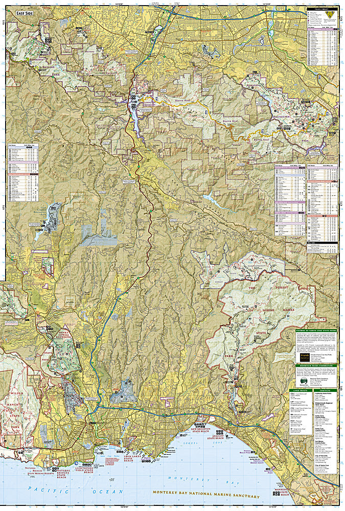
National Geographic Trails Illustrated Big Basin & Santa Cruz Map #816 — waterproof, tear-resistant. Coverage of Big Basin Redwoods State Park, the Santa Cruz Mountains, and the Skyline-to-the-Sea Trail in California. GPS-compatible.
The National Geographic Trails Illustrated Big Basin & Santa Cruz Map covers the Santa Cruz Mountains — Big Basin Redwoods State Park (California's oldest state park), the Skyline-to-the-Sea Trail, Castle Rock State Park, and surrounding state parks and open space. Hiking and mountain biking trails, redwood groves, trailheads, and GPS coordinates are mapped in detail.
Key specs
- SKU: NGTI816
- Map number: 816
- Coverage: Big Basin & Santa Cruz Mountains, California
- Material: Waterproof, tear-resistant paper
- Features: Trails, Skyline-to-the-Sea Trail, redwood groves, mountain biking routes, trailheads, GPS coordinates
Why it works
The Santa Cruz Mountains' network of state parks and open space preserves offers extensive hiking and mountain biking accessible from the San Francisco Bay Area and Silicon Valley — a map covering the full range from the Skyline ridge to the coast is essential for planning point-to-point trips like the Skyline-to-the-Sea Trail. Big Basin's old-growth redwood groves and the trail network connecting multiple parks require detailed mapping to navigate efficiently. Waterproof construction survives the coastal fog and rain common in the Santa Cruz Mountains year-round.
Ideal for
Hikers, mountain bikers, and nature lovers exploring Big Basin Redwoods State Park, the Skyline-to-the-Sea Trail, and the Santa Cruz Mountains. See also NGTI815 (Skyline Boulevard) for adjacent coverage along the Peninsula.
Share