National Geographic
Boston Harbor Islands: Map #265
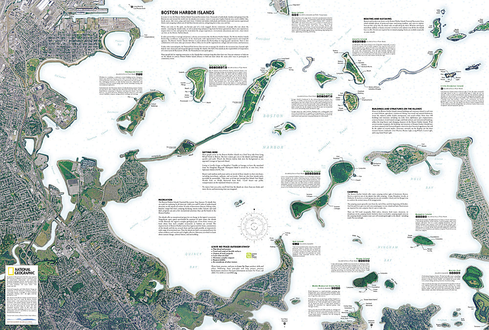
Boston Harbor Islands: Map #265
Couldn't load pickup availability
National Geographic Trails Illustrated Boston Harbor Islands Map #265 — waterproof, tear-resistant. Coverage of the Boston Harbor Islands National Recreation Area including all major islands, ferry routes, and surrounding harbor waterways in Massachusetts. GPS-compatible.
The National Geographic Trails Illustrated Boston Harbor Islands Map covers the full Boston Harbor Islands National Recreation Area — Georges Island (Fort Warren), Spectacle Island, Peddocks Island, Lovells Island, and surrounding harbor islands. Ferry routes, island trails, campgrounds, historic forts, and GPS coordinates are mapped in detail.
Key specs
- SKU: NGTI265
- Map number: 265
- Coverage: Boston Harbor Islands National Recreation Area, Massachusetts
- Material: Waterproof, tear-resistant paper
- Features: Ferry routes, island trails, campgrounds, historic forts, Georges Island, Spectacle Island, GPS coordinates
Why it works
The Boston Harbor Islands' 34 islands and peninsulas are accessible only by ferry, with each island offering different recreation opportunities — accurate ferry route, landing site, and island trail mapping is essential for planning day trips and overnight camping visits. The islands' historic forts and the harbor's tidal patterns require detailed location and access information. Waterproof construction is essential in a marine environment where maps are constantly exposed to salt spray and ocean conditions.
Ideal for
Day trippers, campers, history enthusiasts, and kayakers exploring the Boston Harbor Islands National Recreation Area off the Massachusetts coast.
Share