National Geographic
Mammoth Cave National Park: Map #234
Mammoth Cave National Park: Map #234
Couldn't load pickup availability
National Geographic Trails Illustrated Mammoth Cave National Park Map #234 — waterproof, tear-resistant. Coverage of Mammoth Cave National Park including surface hiking trails, the Green River, and surrounding park lands in Kentucky. GPS-compatible.
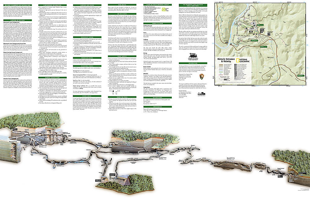
The National Geographic Trails Illustrated Mammoth Cave National Park Map covers the full national park — the world's longest known cave system, surface hiking trails through the park's forests and river bottoms, the Green River, and surrounding park lands. Surface trails, river access, cave tour entry points, campgrounds, and GPS coordinates are mapped in detail.
Key specs
- SKU: NGTI234
- Map number: 234
- Coverage: Mammoth Cave National Park, Kentucky
- Material: Waterproof, tear-resistant paper
- Features: Surface trails, Green River access, cave tour entry points, campgrounds, GPS coordinates
Why it works
Mammoth Cave National Park offers both underground cave tours and an extensive surface trail network that most visitors overlook — a map covering the full surface trail system and the Green River corridor provides a complete picture of the park's above-ground recreation opportunities. The Green River's paddling and fishing access requires detailed put-in and take-out mapping. Waterproof construction survives Kentucky's frequent rain and the humid environment near the cave entrances.
Ideal for
Cave explorers, hikers, paddlers, and park visitors exploring Mammoth Cave National Park's surface trails and Green River in Kentucky.
Share