National Geographic Trails Illustrated Chattahoochee Map Pack Bundle — waterproof, tear-resistant, detailed topography, hiking trails, whitewater routes, waterfalls, and campgrounds. For hikers, rafters, and nature lovers in the southern Appalachians.
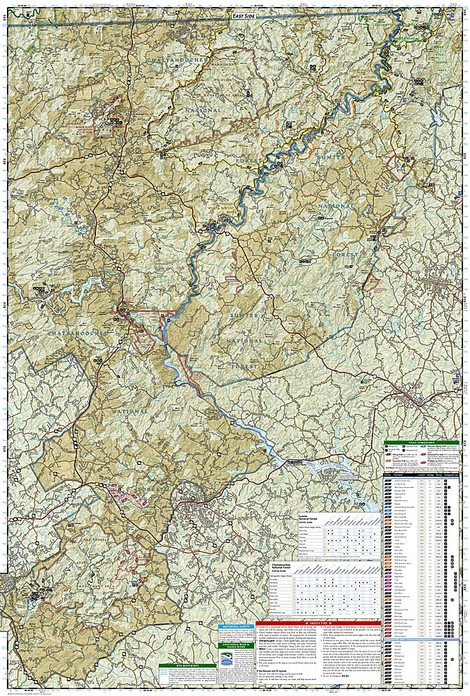
The National Geographic Chattahoochee Map Pack Bundle includes the Trails Illustrated maps covering the Chattahoochee-Oconee National Forests and the Chattooga Wild and Scenic River corridor across Georgia and South Carolina. Detailed topography, trail networks, whitewater rafting routes, waterfalls, and campgrounds on waterproof, tear-resistant paper.
Key specs
SKU: NGTIB030
Coverage: Chattahoochee-Oconee National Forests and Chattooga River corridor (GA/SC)
The Chattahoochee-Oconee National Forests span a large area of the southern Appalachians across two states, with the Chattooga River corridor crossing the Georgia-South Carolina border — a bundle covering the full area ensures complete coverage without gaps between state maps. The Chattooga River's whitewater sections and the surrounding trail network require detailed mapping that standard forest maps don't provide. Waterproof construction survives the humidity and frequent rain common in the southern Appalachians.
Ideal for
Hikers, rafters, backpackers, and nature lovers exploring the Chattahoochee-Oconee National Forests and the Chattooga Wild and Scenic River in Georgia and South Carolina.