National Geographic
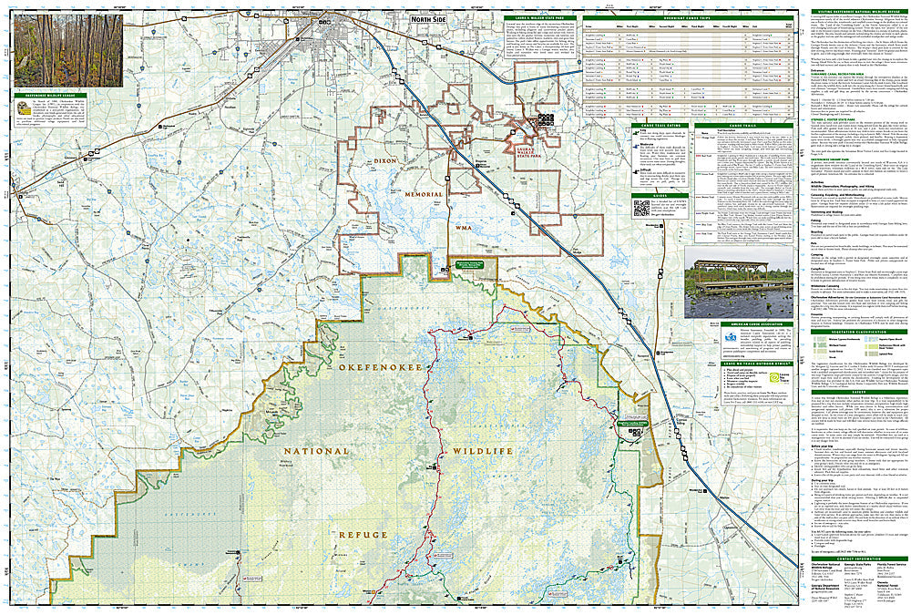
Okefenokee National Wildlife Refuge: Map #795
Okefenokee National Wildlife Refuge: Map #795
Couldn't load pickup availability
National Geographic Trails Illustrated Okefenokee National Wildlife Refuge Map #795 — waterproof, tear-resistant. Coverage of the Okefenokee National Wildlife Refuge including canoe trails, camping platforms, and the vast blackwater swamp ecosystem spanning Georgia and Florida. GPS-compatible.
The National Geographic Trails Illustrated Okefenokee National Wildlife Refuge Map covers the full Okefenokee swamp — one of the largest intact freshwater ecosystems in North America — spanning the Georgia-Florida border. Canoe trails, camping platforms, day use areas, wildlife viewing areas, and GPS coordinates are mapped in detail.
Key specs
- SKU: NGTI795
- Map number: 795
- Coverage: Okefenokee National Wildlife Refuge, Georgia and Florida
- Material: Waterproof, tear-resistant paper
- Features: Canoe trails, camping platforms, day use areas, wildlife viewing areas, GPS coordinates
Why it works
The Okefenokee's vast blackwater swamp is notoriously difficult to navigate without a detailed map — the canoe trail network, camping platform locations, and permit zones are essential for planning multi-day paddling trips through the swamp's interior. The refuge's alligator, sandhill crane, and black bear populations make wildlife viewing area detail valuable for visitors. Waterproof construction is essential in the Okefenokee's wet environment where standard paper maps deteriorate quickly.
Ideal for
Paddlers, wildlife watchers, and nature lovers exploring the Okefenokee National Wildlife Refuge's canoe trails and swamp ecosystem in Georgia and Florida.
Share