National Geographic
Fort Myers Beach: Map #407
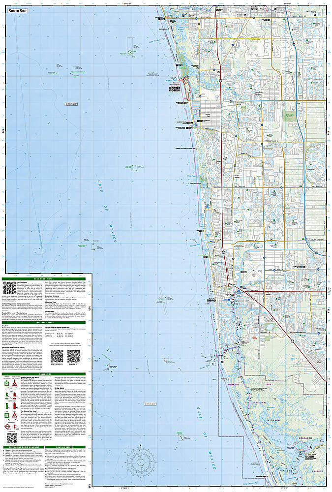
Fort Myers Beach: Map #407
Couldn't load pickup availability
National Geographic Trails Illustrated Fort Myers Beach Map #407 — waterproof, tear-resistant. Coverage of Fort Myers Beach, Estero Bay, Pine Island Sound, and surrounding Southwest Florida coastal waterways and parks. GPS-compatible.
The National Geographic Trails Illustrated Fort Myers Beach Map covers the Southwest Florida coastal area — Fort Myers Beach, Estero Bay Aquatic Preserve, Pine Island Sound, Lovers Key State Park, and surrounding coastal waterways. Paddling routes, boat access, beach access, nature trails, and GPS coordinates are mapped in detail.
Key specs
- SKU: NGTI407
- Map number: 407
- Coverage: Fort Myers Beach & surrounding coastal waterways, Southwest Florida
- Material: Waterproof, tear-resistant paper
- Features: Paddling routes, boat access, Estero Bay, Pine Island Sound, beach access, nature trails, GPS coordinates
Why it works
The Fort Myers Beach area's complex network of barrier islands, tidal channels, and mangrove waterways makes navigation by kayak or small boat challenging without a detailed map — accurate channel, access point, and launch site mapping is essential for safe paddling in this coastal environment. Estero Bay's shallow waters and the surrounding aquatic preserve require detailed depth and access information. Waterproof construction is essential in a marine environment where maps are constantly exposed to water and salt spray.
Ideal for
Kayakers, paddlers, boaters, beachgoers, and nature lovers exploring Fort Myers Beach, Estero Bay, and the Southwest Florida coastal waterways. See also NGTI402 (Marco Island & Ten Thousand Islands) for adjacent coverage to the south.
Share