National Geographic
Marco Island, Ten Thousand Islands: Map #402
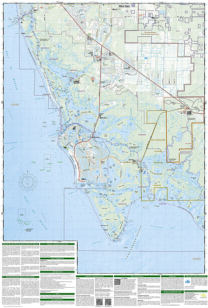
Marco Island, Ten Thousand Islands: Map #402
Couldn't load pickup availability
National Geographic Trails Illustrated Marco Island & Ten Thousand Islands Map #402 — waterproof, tear-resistant. Coverage of Marco Island, the Ten Thousand Islands, Everglades National Park's western boundary, and surrounding Southwest Florida coastal waterways. GPS-compatible.
The National Geographic Trails Illustrated Marco Island & Ten Thousand Islands Map covers the Ten Thousand Islands region of Southwest Florida — Marco Island, the maze of mangrove islands and tidal channels of the Ten Thousand Islands, the Wilderness Waterway, and the western boundary of Everglades National Park. Paddling routes, boat access, campsites (chickees and ground sites), and GPS coordinates are mapped in detail.
Key specs
- SKU: NGTI402
- Map number: 402
- Coverage: Marco Island & Ten Thousand Islands, Southwest Florida
- Material: Waterproof, tear-resistant paper
- Features: Paddling routes, Wilderness Waterway, chickee campsites, boat access, mangrove channels, GPS coordinates
Why it works
The Ten Thousand Islands' maze of mangrove channels is notoriously difficult to navigate without a detailed map — the islands look nearly identical from water level and GPS coordinates are essential for finding campsites and exits. The Wilderness Waterway's 99-mile canoe route through the Everglades requires accurate chickee and ground campsite location mapping for permit compliance. Waterproof construction is essential in a marine environment where maps are constantly exposed to water and salt spray.
Ideal for
Sea kayakers, canoeists, anglers, and Wilderness Waterway paddlers exploring the Ten Thousand Islands and western Everglades in Southwest Florida. See also NGTI407 (Fort Myers Beach) for adjacent coverage to the north.
Share